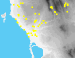
 I29 Romanou Kokevis Estate
Site I29 lies ca. 200 m. W of the former Kokkevis mansion, ca. 700 m. NW of the modern village of Romanou. The site comprises an unusually flat basin[087.30] of approximately rectangular form with relatively steep slopes, bounded on the S by the Selas river.
Originally identified from aerial photographs, the basin was cored by hand in 1993 and power-driven rotary drill in 1994[087.14][087.26] to determine whether it had held water and therefore may have functioned as an artificial harbor basin for the palatial center on the Englianos ridge. The coring confirmed that the basin had been open, probably in prehistoric times (indicated by the discovery of a chipped stone tool and a piece of pottery in two of the drill holes). It is possible that the basin was filled in as a result of catastrophic erosion event in the wake of the collapse of the palatial system.