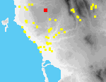
 I22 Floka Panitsa
The site of Panitsa lies on the summit and slopes of a knoll at the N end of the Panitsa ridge, ca. 1 km. NNW of the modern village of Floka.[092.32] There is a Greek army trigonometric marker on top of the knoll. To either side of the ridge are deep ravines that feed the upper tributaries of the Lagkouvardos River. The knoll and its slopes are planted with olives.
The knoll is relatively flat on top, and a rubble field wall divides it. There are several stone terrace walls on the slopes of the knoll (especially W of the summit).
In 1995, a rotary hand mill[092.29] made of fine-grained (non-local?) conglomerate was found at the S foot of the knoll.
Only 8 fragments of pottery were collected from this site. Six of these are of local manufacture, including three fragments of "blue design" plates. This local material probably belongs to the late 19th to early 20th century. A probable import from England (922000-1) and a cup rim of Turkish type (922000-2) are 19th cy. in date.