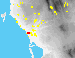
 I17 Tragana Tsopani Rahi
The tumulus of Tsopani Rahi is located on a low rise, some 1.5 km. SW of Tragana-the highest elevation within a vast expanse of open, sandy fields, in a few of which watermelons are today grown.[096.06][096.07] The rise is completely covered with brambles and weeds and visibility is very poor; a modern airbrick fieldhouse[096.14] has been recently rebuilt on top of it. SW of the rise, fields slope gently to the sea.
Hellenistic tombs in the tumulus (then 20 m. x 25 m. x 1.5 m. H.) were excavated in the early 1960s. Both slab-lined cists and wooden coffins were discovered, with associated finds of gold diadems, a silver vase, glass vases, bronze and silver coins, lamps, much pottery, and a large stele base. In 1995, a large worked slab (0.8 m. L. x 0.65 m. W. x 0.1 m. Th.), probably a cover slab for a grave,[096.13] was the only visible trace of the excavated cemetery.