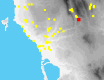
 A04 Metamorfosi Skarminga
Site A4 covers an extensive area N and S of a deep ravine N of Metamorfosi, reaching the northern outskirts of the modern village, and, as well as the slopes of the ravine, includes flat fields adjacent to it. The site has the character of an amphitheater, and there are excellent views toward the W, into the Metaxada Valley. The area is well-watered. In addition to the spring at Ayia Sotira (see below), there are two other springs in the vicinity, one at Ayios Konstadtinos (Site A6, ca. 1 km. NW) and one in the modern village of Metamorfosi.
The majority of fields that comprise the site are intensively cultivated in olives, vines, tree crops, and vegetables. Fields descend the slopes of the ravine on a series of terraces, some of them supported by rubble retaining walls. Numerous pipelines provide irrigation for many of these fields, the water supplied from cisterns near Ayia Sotira. Several field houses are linked by dirt tracks. One older stone-walled track (or kalderimi) was partly destroyed in 1994; it apparently led east to the church of the Panayia, ca. 600 m. W of the village of Touloupa Hani. Another old stone-walled track is preserved further N, near the church of Ayios Ioannis.
The modern church of Ayios Ioannis is located at the N edge of the site[087.09], the Byzantine church of the Transfiguration (Ayia Sotira) approximately at its center.[111.10] The church of Ayia Sotira has been repaired and altered on several occasions; its earliest parts probably date to the Late Byzantine period.[092.18] A copious spring rises under the church and there is a small collecting basin for water next to it.
In a field SW of Ayia Sotira, there are three large fragments of masonry, built of small stones, tile and mortar.[092.17] These fragments lie immediately S of a water channel cut into the bedrock, which probably once carried water from the spring at Ayia Sotira.
The channel[111.19] can be traced for at least 150 m.; over part of its course it holds a modern irrigation pipe. It runs W, then bends S to skirt the base of a flat-topped spur which projects S over the ravine. Here part of the channel is lined with stone.
At the nose of the spur, near the channel, there is preserved the corner of a rectangular structure[111.14] (max. pres. dimensions, 4.5 m. x 3.2 m.; wall thickness 0.6-1.9 m.) believed locally to be the remains of a "Turkish bath" (the area is called Loutra). There are many traces of waterproof mortar on the inside faces of the walls. The original structure appears to have been built of carefully cut and neatly set stones, laid in place with mortar; stones and pieces of Early Modern tile are cemented on top of it. In 1995 we noted that a hole had been dug at the E side of the structure, exposing fragments of pottery and tile.
Cores for pollen analysis were extracted from the floor of the ravine in 1994; they contained very little pollen and the state of preservation of the pollen they contained was poor.
Archaic, Classical, Hellenistic, and Roman pottery was found primarily in the southern part of the site. In contrast, large quantities of Byzantine pottery were collected in the vicinity of the church of Ayia Sotira. Most pieces belong specifically to the twelfth and thirteenth centuries, roughly contemporary with the likely date of its construction in the 13th century. Byzantine ceramics were also collected in the northwest corner of the site.
The collected pottery from this site covers a wide chronological range, from Archaic to Byzantine, with a few later pieces. The Medieval pottery from this site is fairly well-preserved and represents a poorer level of Byzantine pottery forms represented at such sites as Nihoria, in terms of both fabrication and decoration.