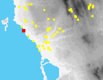
 I28 Vromoneri Vergina Rema
Site I28 is located approximately 3.25 km. SE of Marathopolis, on top of cliffs (ca. 15 m. high), that rise above a small, semi-circular cove, unprotected from west winds.[110.13] The edge of the cliff is jagged and covered with patches of grass and maquis.[090.32]; farther inland there are exposed bedrock outcrops and there is low maquis on the hillslopes that rise above the cliffs. Here and there are exposures of deep red Pleistocene paleosols. These soils are thin everywhere on the site, although several isolated columns of earth are preserved as high as half a meter or more, where the soil has been protected from erosion by vegetation.[090.31]
The locations of all lithic artifacts and potsherds were individually mapped using a totalstation. 128 chert chipped stone tools were recorded E and W of a dirt agrarian road, in a narrow band ca. 120 m. long and ca. 20 m. wide, immediately S of the Vergina stream. Many appear recently to have eroded from the scarps of columns of preserved soil. Others are present in a column of Pleistocene soil alluvium N of the cliffs, near the mouth of the stream. There Middle Palaeolithic artifacts were found embedded in the scarp of the column, at a depth of ca. 0.6 m beneath the modern surface.[110.14][091.02] EBA pottery was concentrated in a much smaller area (ca. 20 x 20 m.) at the southern end of the site.
The appearance of the site has probably not changed greatly since the Early Bronze Age; in the Palaeolithic it is necessary, however, to imagine an extensive beach and coastal plain to the W of the present sea cliffs.
One or two small fragments of EH coarse pottery were collected from most grid squares. The dark red to brown color and the gritty texture are similar to Nozaina ware (cf. site I20). All the pieces are body sherds except for one T-rim bowl rim. This shape and the fabric suggest an EH II date for the pottery.