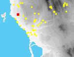
 D02 Gargaliani Megas Kambos (1)
The site lies on an elongated (NW-SE) rise with a trigonometric point (104 masl.) ca. 3 km. E of Marathopolis[090.19]. The rise is part of a series of knolls on the coastal plain below (W of) the modern town of Gargaliani[098.35]. The rise slopes gradually to the N, S and W, with a more abrupt drop to the NE. The top is largely covered with maquis, dissected by goat paths, with some open grassy areas. The N and NW slopes are currently planted with grassy mature olives and there are occasional outcrops of bedrock. Intensive market gardening is being practiced on the E side of the hill. The S knoll has many exposed rock outcrops interspersed with grassy areas; at the bottom of the slope are extensive olive groves. On the SE slope is a bedrock cutting consisting of a vertical face with two short returns (perhaps a quarry)[090.14]. Although the elevation is slight in absolute terms, visibility from the site is good, particularly to the W, E, and S [090.16]
Material on the site divides into two distinct phases: PR (particularly LH I-II and LH IIIA-B) and A-R. PR material was identified in all four quadrants, whereas A-R artifacts predominate in the S part of the low ridge (Q2). A significant PR find was a shaft-hole hammer axe of probable MH I date. Since 1994, significant bulldozing and brush clearance has taken place along the southern boundary of the site (along and above the line where the ridge meets the flatter contours of olive fields)[090.11].
Whole trees have been uprooted at the SE edge of the site, closest to the encroaching market gardens. Many potsherds and tile fragments can now be seen here, suggesting that further collection of the site would produce appreciably higher densities in this area than in 1994.
Prehistoric material is dispersed over all the site, with very few diagnostic pieces in any one area. Geometric-Roman material is chiefly concentrated [in the second quadrant]; again there are few good shapes but much tile, including glazed pieces.