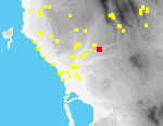
 B08 Hora Triandafyllies
Parts of two chamber tombs have been destroyed by the bulldozing of terraces for olive cultivation between switchback turns in the Hora-Myrsinohori asphalt road, E of Koukouyera, where the road descends into a deep valley separating the uplands S of Hora (Triandafyllies) from the Vayies ridge NW of Myrsinohori.
Only the back of the chamber of Tomb A is preserved (1.75 m. H. x 1.5 m. W. by 1.5 m. deep).[113.03][094.34] The front of the chamber and the dromos of the tomb were destroyed when the terraces were cut (not recently since they support mature olive trees).
Tomb B lies lower down the slope to the south, at the end of a small spur that projects SE; a bulldozer cut around the end of the spur has cut the tomb in two and only its back part has been preserved. It is covered today with slope debris and brush.[094.35]
No artifacts can be clearly associated with the use of either tomb. Pottery collected in the vicinity of the tombs was of modern date.
This site contained one modern sherd and two modern tiles.