 I01
Koryfasio Beylerbey
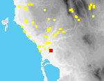
Beylerbey is a long ridge that rises ca. 15 m. above the coastal plain, ca. 700 m. S of the outskirts of the modern village of Koryfasio.[096.08][114.15] Site I1 is located on the northern of the two knolls that form the ridge[096.02].
Artifacts are most dense on the broad flat top of this knoll, but are also found on its slopes, and in the fields around it.
The northern knoll is bordered to the W and E by dirt roads, and on the N by a stream. In the NW, traces of an old stone roadway are visible in the bed of the modern road. On the top and slopes of the knoll there are several small field houses and a cement floor for drying currants. Almost the entire site is covered with mature olives; there are a few scattered almonds.
The site has been known for nearly a century. Skias reported a bronze sword from Beylerbey in the possession of a resident of Koryfasio in 1909. According to McDonald and Hope Simpson, tombs are supposed to have been found in the saddle between the two knolls, and probably on the E slope of the northern knoll where they also note walls, perhaps of houses. Pottery they themselves collected was mostly of LH IIIB date, with some possibly of LH II and LH IIIA. In test excavations, Marinatos found almost no architectural remains and excavated deposits were very shallow in depth, leading him to draw the conclusion that the site was small and insignificant.
Magnetometry and geological coring sponsored by PRAP also suggest that there are no substantial cultural deposits beneath the plow zone. Virtually all of the 28 augur cores extracted at Beylerbey reached bedrock at depths of 0.2-0.5 m. It seems clear that the entire site consists only of a thin veneer of soil and artifacts, resting on bedrock. This entire soil unit has been greatly disturbed by plowing. Magnetometry survey similarly did not succeed in identifying in situ subsurface architectural remains.
It is, however, also clear that the site was once very large and was a center for settlement in the area. Artifacts were collected by our teams in some 300 20 x 20 sq. m. grid squares. Preliminary analysis suggests that the site was inhabited in most prehistoric and historic periods.
Study of material from this site is still in progress, and no pieces have yet been catalogued.