 D01
Gargaliani Kanalos
D01
Gargaliani Kanalos
Tile: HL, Byz-Turk?, EMod, Mod
The center of the site of Kanalos is located ca. 3 km. E of Marathopolis on a low tongue-shaped ridge, or interfluve, that extends SW from the foothills overlooking the coastal plain of Dialiskari from the east; the interfluve is defined by two streams that join west of the ridge and flow from there to the coast at Dialiskari.[018.14] Immediately west of Kanalos the bed of the stream is deeply incised and narrow; near the coast it becomes broader and more shallow.
McDonald and Hope Simpson first described archaeological remains at Kanalos in 1961, including traces of ancient walls (?prehistoric fortifications), "several good squared, hammer-dressed poros blocks" (?from a late C-HL temple), and pottery of both prehistoric and historic date. 400 m. to the southeast they also described the remains of a burial mound; in 1982 MH and LH pottery was recovered when a second nearby mound was bulldozed.
On the SW the ridge is steep; at its foot is a small spring, surrounded by bamboo and reeds. We were told in 1993 that the spring ran only in the winter, but we observed running water there in summer 1995. McDonald and Hope Simpson reported Turkish brickwork surrounding the spring but no traces of it remain. To the S and W, the ridge drops precipitously down maquis-covered slopes to flat fields currently used as gardens. To the N and east, it descends more gently into olive groves. There is a cypress forest immediately NE.
The ridge consists of two flat-topped knolls, separated by a small saddle. On the northern, higher knoll there are many tile fragments on and around a roughly circular mound of earth. At the E side of this knoll, on a terrace, is a line of stones (perhaps a wall), oriented NE-SW and ca. 45 m. in length; ca. 15 m. to the NW of its N end are stones that might belong to another wall preserved 6-7 m. in length and oriented E-W. Immediately N of it a truncated wall is visible in the bulldozed N scarp of the knoll. From the scarp we collected large quantities of fine pottery; on the surface of the knoll around the remains of the walls there was little but fragments of tile.
McDonald and Hope Simpson (PHSP1: 237 [38]) reported remains of a possible "temple" on the northern knoll. We found at least three ashlar blocks (0.5 m. x 1.7 m.; 0.5 m. x 0.5 m. x 0.4 m.; 0.65 x 0.65 m. x 1.08 m.) that may belong to a monumental structure: one at the NE edge of the knoll, one at the NW edge, a third on the NW slope.[034.08] There has been considerable bulldozing in this part of the ridge since McDonald and Hope Simpson visited.At the western edge of the saddle between the two knolls there are many large boulders, presumably part of the "Cyclopean" wall indicated by McDonald and Hope Simpson [PHSP1: 236, ill. 7]) on their sketch plan of the site. We are not certain, however, if these boulders actually belong to a wall or are part of a natural geological formation.[023.07] The boulders may, in part, have been piled into a natural v-shaped hollow to support a terrace to the E.[023.05]
On top of the southern knoll there are three rock cut tombs (c. 0.5 m. x 1.88 m. x 0.48 m. deep; 0.70 m. x 1.4 m.; 0.75 x 1.75 m.), each oriented in a different direction (300 degrees , 360 degrees , and 200 degrees).[018.15] A tile grave with human bones was visible in the very eroded E scarp of this knoll in 1993.[018.25]
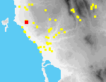
An area of approx. 0.75 ha. was gridded in 1993, encompassing both knolls, their slopes, and the saddle between them. Tract-walking suggests that the site is substantially larger than this area, but our request to continue work in 1994 was denied by the Greek Archaeological Service.
Antiquities at Kanalos are at considerable risk of destruction. Between summer 1992 and summer 1993, several holes were dug on the top of the southern knoll, apparently by antiquities robbers. In 1995 we found no new signs of looting, but the site had been substantially modified in other ways. A gravelled road now leads to the spring, and the SW end of the ridge has been bulldozed. A channel for irrigation pipes (up to 1 m. deep) was dug through fields that border the ridge on the east.[110.01]
There were new irrigated gardens in the valley W of the ridge. Scarps in the N and SE eroded further, and many ancient artifacts were visible in them. At the E edge of the southern knoll was a large hole, perhaps the remains of another grave, the roof of which has collapsed.
Study of the material from this site is still in progress. Pottery ranges in date from MH to Modern, but only a few pieces have so far been catalogued.