PRAP Site Gazetteer
 A01
Metamorfosi Ayios Konstadtinos (1)
Periods Represented
(HL-Byz)
Max Dimension
70 m. (NW/SE) x 30 m. (SW/NE)
Actual Area in Hectares
0.14 ha.
On-site Density (Sherds per Hecatare)
6.99
Ratio of On-site Density to Off-site Density
602
Collection Strategy
Selection (S) => Grab by locus (L)
Location and Description
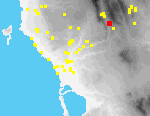
Site A1 consists of at least 16 graves that lie on both sides of a bulldozed dirt road, at the E side of the Metaxada valley, some 3 kms. SE of Metaxada village. Graves are located both E and W of the road.
On the E side of the road is a high (4.5 m.) exposed and eroding scarp. Graves of two types were observed in a thin band of soil covered by maquis at the edge of the scarp, more or less at the same elevation, and partly cut into bedrock; in several instances, faint traces of the edges of the pits in which the graves were set can be discerned.[002.20] The graves are spread N-S along the scarp over a distance of ca. 70 m. Thirteen small concentrations of tile mark the remains of tile graves (#1-12, 15). Three limestone slabs arranged in an inverted "pi" shape probably mark the remains of a cist grave.[002.08]
Human bone fragments were found protruding from the scarp and lying at its base. Amidst bushes at foot of the scarp there are rocks and tile fragments that probably have fallen from graves above.
Immediately W of the scarp on the other side of the road, there is a flat bulldozed terrace with a large square depression at its center, probably a gravel quarry.[091.33]. A tile grave (#16) was noted near the SW corner of the terrace.[091.34][091.35] Two tile graves (#13-14) were observed near the S edge of the terrace in the N scarp of a heavily overgrown track, near the main dirt road.
Since the site was first explored by PRAP in 1992, scarps have further eroded. Two new graves were observed in 1995.
Intervisible Sites
Metamorfosi Skarminga (A4); Metaxada Kalopsana (1) (A2)
Artifact Summary
Material from this site consists of undiagnostic tile fragments and worn body sherds associated with tile graves. The surface of the pottery is too abraded to provide a secure date. The fabric and finger swirl decoration of the catalogued tile must be dated broadly Hellenistic-Byzantine.
References
-
All texts and images made available through The Pylos Regional Archaeological Project: Internet Edition are for personal use only. Reproduction of these materials without prior permission is prohibited.
Questions about the PRAP online database can be addressed to John Wallrodt at john.wallrodt@uc.edu.
 A02
Metaxada Kalopsana (1)
Periods Represented
MH, LH I-II, (LH IIIA), (G?), (Mod)
Tile: Mod
Max Dimension
360 m.(N-S) x 280 m. (E-W)
Actual Area in Hectares
6.88 ha.
On-site Density (Sherds per Hecatare)
5.36
Ratio of On-site Density to Off-site Density
230
Collection Strategy
Selection (S) => Micro-tract (M)
Location and Description
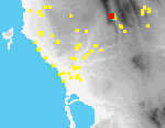
The site lies ca. 1.4 km. SSW of Metaxada village, on the top and N, E and S slopes of a spur extending E from the Aigaleon ridge into the Metaxada valley[101.22], of which it offers a fine view. This spur, linked to the ridge by a narrow neck, marks a route - taken by a now overgrown track - to a saddle over the ridge between the sections called Adtilaris (to the S) and Analipsi (to the N). The spur is bordered to the N and S by ravines. NE of the flattish top of the spur are conglomerate vertical outcrops[091.31][013.06.lbl]. Thickets of maquis and trees now cover much of the site, although parts of the top of the hill and its eastern slopes were burnt in 1991. The amount of terracing suggests the area has been intensively cultivated and the present owner reported that the land was intensively cultivated and grazed as late as the 1950s, although the numerous E and S-facing terraces are today weedy and uncultivated, but still used for grazing. There are also elaborate check dams on the E slopes of the ridge NW of the site. The terrace walls are built in some cases from very large chunks of cut conglomerate bedrock[091.28] (some blocks up to 1 m. L.), although there are also smaller rubble walls. Some of these terraces stand as high as 3-4.5 m. Many other large chunks of conglomerate are strewn across the site.
Intervisible Sites
Metaxada Stylianos (A3); Metamorfosi Skarminga (A4); Metaxada Kalopsana (2) (A5)
Artifact Summary
98% of the pottery from the site is MH-LH coarse wares, most not more closely datable. There are very few shapes. Pithos fragments are quite common, including bases and raised bands of rope decoration. There are fragments of several LH I-II plain fine ware vessels, but only one sherd of definite LH III date (LH IIIA). Two pedestalled feet resemble Geometric (?) example found at L2 (Stou Farfa Ti Rahi).
References
UMME #22; PHSP3: 147 [47B]
All texts and images made available through The Pylos Regional Archaeological Project: Internet Edition are for personal use only. Reproduction of these materials without prior permission is prohibited.
Questions about the PRAP online database can be addressed to John Wallrodt at john.wallrodt@uc.edu.
 A03
Metaxada Kalopsana (3)
Periods Represented
(DA-G), R, Byz
Tile: HL-Byz
contiguous: (EH II)
Max Dimension
20 m. (NW-SE) x 45 m. (NE-SW)
Actual Area in Hectares
0.05 ha.
On-site Density (Sherds per Hecatare)
8.18
Ratio of On-site Density to Off-site Density
243
Collection Strategy
(S) => Grab by locus (L)
Location and Description
A small raised knoll - about 45 m. long and 20 m. wide - lies ca. 2 km S of Metaxada village at the SW end of a low ridge extending from the E side of the Metaxada valley[091.25]. Vineyards lie to its W and S, and weedy fields to the N and E; there are occasional olive trees planted in the vicinity. High maquis and fully grown trees cover most of the feature, the more open W end of which is marked by a horseshoe-shaped cavity. Substantial parts of it, on its NW and S[091.23] sides, have been bulldozed to expand the surrounding fields.
Fragments of tile, human bone, and a very little pottery were discovered in several discrete locations in the scarps exposed and at their base. The four loci (#2-5) with associated material were all located on the NW side of the knoll. Fragments of human bone were recovered from one of these (Locus 2), as was a small Roman glass vessel. Locus 1, located at the SW corner of the knoll, was a stone-filled pit, but no artifacts were obviously associated with it. 10-12 long, flat slabs were visible in the S scarp, on top of the knoll, and to its N and W. Small, unworked stones and tile fragments are common in addition to the slabs.
Revisitation in 1995 revealed artifacts similar to those collected in 1992 in the eroding scarps of the knoll and in the fields at its base.
Intervisible Sites
Metaxada Kalopsana (1) (A2); Metaxada Kalopsana (2) (A5)
Artifact Summary
This site contained ceramics collected from disturbed graves and a tile pile. Diagnostic pottery dates to Dark Age-Geometric, Roman and Byzantine periods. The collected pottery is primarily from Roman-Byzantine cookware vessels.
References
-
All texts and images made available through The Pylos Regional Archaeological Project: Internet Edition are for personal use only. Reproduction of these materials without prior permission is prohibited.
Questions about the PRAP online database can be addressed to John Wallrodt at john.wallrodt@uc.edu.
 A04
Metamorfosi Skarminga
Periods Represented
(A?), (C), HL, ER-MR, LR, Byz, Ott, EMod, Mod
Max Dimension
900 m. (N-S) x 1180 m. (E-W) (maxima)
Actual Area in Hectares
39.81 ha.
On-site Density (Sherds per Hecatare)
15.98
Ratio of On-site Density to Off-site Density
1805
Collection Strategy
Selection (S) => Micro-tract (M) => Vac. circle (VC)
Location and Description
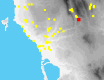
Site A4 covers an extensive area N and S of a deep ravine N of Metamorfosi, reaching the northern outskirts of the modern village, and, as well as the slopes of the ravine, includes flat fields adjacent to it. The site has the character of an amphitheater, and there are excellent views toward the W, into the Metaxada Valley. The area is well-watered. In addition to the spring at Ayia Sotira (see below), there are two other springs in the vicinity, one at Ayios Konstadtinos (Site A6, ca. 1 km. NW) and one in the modern village of Metamorfosi.
The majority of fields that comprise the site are intensively cultivated in olives, vines, tree crops, and vegetables. Fields descend the slopes of the ravine on a series of terraces, some of them supported by rubble retaining walls. Numerous pipelines provide irrigation for many of these fields, the water supplied from cisterns near Ayia Sotira. Several field houses are linked by dirt tracks. One older stone-walled track (or kalderimi) was partly destroyed in 1994; it apparently led east to the church of the Panayia, ca. 600 m. W of the village of Touloupa Hani. Another old stone-walled track is preserved further N, near the church of Ayios Ioannis.
The modern church of Ayios Ioannis is located at the N edge of the site[087.09], the Byzantine church of the Transfiguration (Ayia Sotira) approximately at its center.[111.10] The church of Ayia Sotira has been repaired and altered on several occasions; its earliest parts probably date to the Late Byzantine period.[092.18] A copious spring rises under the church and there is a small collecting basin for water next to it.
In a field SW of Ayia Sotira, there are three large fragments of masonry, built of small stones, tile and mortar.[092.17] These fragments lie immediately S of a water channel cut into the bedrock, which probably once carried water from the spring at Ayia Sotira.
The channel[111.19] can be traced for at least 150 m.; over part of its course it holds a modern irrigation pipe. It runs W, then bends S to skirt the base of a flat-topped spur which projects S over the ravine. Here part of the channel is lined with stone.
At the nose of the spur, near the channel, there is preserved the corner of a rectangular structure[111.14] (max. pres. dimensions, 4.5 m. x 3.2 m.; wall thickness 0.6-1.9 m.) believed locally to be the remains of a "Turkish bath" (the area is called Loutra). There are many traces of waterproof mortar on the inside faces of the walls. The original structure appears to have been built of carefully cut and neatly set stones, laid in place with mortar; stones and pieces of Early Modern tile are cemented on top of it. In 1995 we noted that a hole had been dug at the E side of the structure, exposing fragments of pottery and tile.
Cores for pollen analysis were extracted from the floor of the ravine in 1994; they contained very little pollen and the state of preservation of the pollen they contained was poor.
Archaic, Classical, Hellenistic, and Roman pottery was found primarily in the southern part of the site. In contrast, large quantities of Byzantine pottery were collected in the vicinity of the church of Ayia Sotira. Most pieces belong specifically to the twelfth and thirteenth centuries, roughly contemporary with the likely date of its construction in the 13th century. Byzantine ceramics were also collected in the northwest corner of the site.
Intervisible Sites
Metaxada Kalopsana (1) (A2); Metamorfosi Ayios Konstadtinos (2) (A6)
Artifact Summary
The collected pottery from this site covers a wide chronological range, from Archaic to Byzantine, with a few later pieces. The Medieval pottery from this site is fairly well-preserved and represents a poorer level of Byzantine pottery forms represented at such sites as Nihoria, in terms of both fabrication and decoration.
References
UMME #23; PHSP3: 152 [69D]
All texts and images made available through The Pylos Regional Archaeological Project: Internet Edition are for personal use only. Reproduction of these materials without prior permission is prohibited.
Questions about the PRAP online database can be addressed to John Wallrodt at john.wallrodt@uc.edu.
 A05
Metaxada Kalopsana (2)
Periods Represented
EMod, Mod
Max Dimension
60 m. (N-S) x 75 m .(E-W)
Actual Area in Hectares
0.39 ha.
On-site Density (Sherds per Hecatare)
3.70
Ratio of On-site Density to Off-site Density
6316
Collection Strategy
Selection (S) => Micro-tract (M) => Vac. circle (VC)
Location and Description
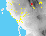
Site A5 is located on the floor of the Metaxada valley, some 1.2 km. SSW of the modern village.[091.32] The asphalt road from Stylianos to Metaxada borders the site on the W; at its N is a small stream, choked with reeds.
Artifacts were concentrated in two adjacent groves of mature olives, separated by a stone terrace wall ca. 1.5 m. high; finds were most plentiful near this wall.
Visibility in one of the two fields was much worse in 1995 than it had been in 1994; the other field had been plowed since the site was collected in 1994 but we found few artifacts in it.
Intervisible Sites
Metaxada Kalopsana (1) (A2)
Artifact Summary
All the ceramic material observed at this site is Early Modern and Modern in date. The majority of collected material is modern tile. Only one fine ware vessel, an Early Modern plate rim, was catalogued (A92-190-1).
References
-
All texts and images made available through The Pylos Regional Archaeological Project: Internet Edition are for personal use only. Reproduction of these materials without prior permission is prohibited.
Questions about the PRAP online database can be addressed to John Wallrodt at john.wallrodt@uc.edu.
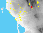 A06
Metamorfosi Ayios Konstadtinos (2)
Periods Represented
(G-A), C, HL, R, Byz, (Ott), Mod
Max Dimension
100 m. (NE-SW) x 70 m. (NW-SE)
Actual Area in Hectares
0.56 ha.
On-site Density (Sherds per Hecatare)
20.48
Ratio of On-site Density to Off-site Density
5207
Collection Strategy
Selection (S) => Micro-tract (M) => Vac. circle (VC)
Location and Description
The small church of Ayios Konstadtinos is located on the E side of the Metaxada valley, about 1.5 km. NNW of Metamorfosi and approximately 600 m. E of the hamlet of Stylianos on the other side of the valley. Visibility is poor. Fields adjacent to the church are for the most part overgrown. The church was entirely re-roofed in 1992; at that time tiles from the older roof were stacked near it and fragments were scattered in the churchyard, making it increasingly difficult to recognize ancient artifacts. W and SW of the church is a gentle slope, with a sharper drop after ca. 70 m.
N of the church is a terrace, separated from the churchyard by a stone retaining wall (ca. 1.5-2.0 m. high) that incorporates many pot sherds and tile fragments.[092.04] In 1992, a ditch was dug through the terrace, and a water pipeline laid to carry water to Stylianos from the spring E of Ayios Konstadtinos. Large quantities of pottery and tile were visible in the scarps of the ditch.
In 1995 weeds in the terraced field had been burnt and visibility was much improved. Two large, well-cut limestone blocks (0.6 m. L. x 0.33 H. x 0.3 m. max. pres. W.; 0.4 L. x 0.25 H. x 0.34 max pres. W.) were found NW of the church; there were other smaller, less carefully worked blocks in this same part of the site.[092.03]
Approximately 20 m. SW of the church are two ruined foundations that contain small worked blocks.[074.29] The W end of the larger structure (designated House A) directly abuts the other (House B). House A (10 m. x 5 m.) is clearly the older building; it has mortared well-built walls, with a door in the center of its eastern side.
House B (8 m. x 4 m.) was built against House A; its entrance (E) cut through the W wall of House A. The walls of House B are built for the most part of small stones of irregular shapes and fragments of tile; the house is still partly roofed. Its SW and NW corners are built of worked limestone blocks laid in a "header and stretcher" arrangement.[074.33]
In the SW corner of House A, there is a tumble of worked blocks (4-5) similar to those in the corners of House B ; near them is a column fragment[074.28] of very battered limestone. The column lies partly embedded in the ground, projecting ca. 0.65 m.; on top is a square dowel hole (8 x 8 cm.) approximately 2 cm. deep. The exterior of the column is now heavily worn; no trace of fluting is preserved, if it ever existed.
Intervisible Sites
Metaxada Kalopsana (1) (A2); Stylianos
Artifact Summary
The pottery collected has a chronological range of Archaic to Modern. Most of the diagnostic pottery is from the Hellenistic period, where the collected sherds can represent a single household assemblage. This assemblage is comparable to the pottery from site E1. Here, however, the vessels represent local fabric versions of fine ware forms. A second diagnostic cluster is from the Byzantine period. Ceramics from this period are table wares and coarse wares common to Messenia. Small quantities of Archaic, Classical, and Roman sherds are also present. Overall, the sherds are in reasonably good condition with a number of large fragments preserved.
References
-
All texts and images made available through The Pylos Regional Archaeological Project: Internet Edition are for personal use only. Reproduction of these materials without prior permission is prohibited.
Questions about the PRAP online database can be addressed to John Wallrodt at john.wallrodt@uc.edu.
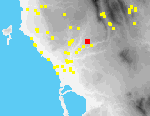 B01
Hora Kalianesi
Periods Represented
(C?), (HL?), ER-MR, LR, Byz, (Ott), Ott-Mod, EMod, Mod
Tile: HL-R
Max Dimension
40 m .(N-S) x 40 m. (E-W)
Actual Area in Hectares
0.14 ha.
On-site Density (Sherds per Hecatare)
4.19
Ratio of On-site Density to Off-site Density
1398
Collection Strategy
Total (T) => Grid (G 10 m.)
Location and Description
Site B1 is located in a small overgrown vineyard on the western slopes of a small spur,[095.12] ca. 750 m. S of the outskirts of the modern town of Hora; the spur slopes W and N into a shallow valley, on the other side of which is the church of Ayios Nikolaos at Kavalaria (Site B2).
When the site was first discovered in 1992, it had been recently plowed and new vines planted.[003.08] Stones dislodged by plowing and hoeing had been gathered in piles by farmers. In 1995 the vineyard was overgrown and few artifacts were visible.
In the stone piles were two large worked slabs (max. pres. dim.: 0.62 W. x 0.5 L. x 0.11 Th.; 0.7 W. x 0.54 H. x 0.15 Th.), both with dowel holes (4 x 4 cm.) on one side (three on the first slab, two on the second).[003.09] Both appear to be spolia from the Palace of Nestor, reused as cover slabs for graves. Human bone was found in several places, and previously the farmers had themselves collected large fragments of a skull and human long bones.
Intervisible Sites
Hora Kavalaria (B2)
Artifact Summary
The ceramic finds range in date from Classical to Early Modern, with an emphasis on the (Hellenistic-)Roman period. Ceramic finds, including vessel fragments and tiles, dating to the Roman and Hellenistic periods were collected [from grid squares 111, 211, 212, 311, 322, and 421]. Sherds from the Byzantine and Turkish periods were collected [in 111, 112, 222, and 321]. These sherds are mostly cooking wares. Few fine wares are represented in the collection. Hellenistic-Roman roof tiles were collected [in grid squares 111, 112, 311]. Later roof tiles were collected [in 411].
References
Georgacas and McDonald 1967 #2345 [toponym]
All texts and images made available through The Pylos Regional Archaeological Project: Internet Edition are for personal use only. Reproduction of these materials without prior permission is prohibited.
Questions about the PRAP online database can be addressed to John Wallrodt at john.wallrodt@uc.edu.
 B02
Hora Kavalaria
Periods Represented
Byz, Ott-EMod, Mod
Max Dimension
340 m. (N-S) x 390 m. (E-W)
Actual Area in Hectares
7.22 ha.
On-site Density (Sherds per Hecatare)
1.95
Ratio of On-site Density to Off-site Density
1279
Collection Strategy
Selection (S) => Micro-tract (M) => Vac. circle(VC)
Location and Description
At the center of Site B2 is the church of Ayios Nikolaos, located at Kavalaria, a flat-topped rise,[113.19] some 600 m. S of the outskirts of the modern town of Hora.[095.13] It is clear from Venetian and Ottoman censuses that there was a village at Kavalaria in the 17th and 18th centuries. The large size of the church and its elaborate architectural decoration suggest that it was the principal ecclesiastical focus of the community.
Artifacts are concentrated around the church and to the E and S of it, on bulldozed terraces and natural slopes that descend into the valley that separates Sites B2 and B1. Almost the entire site is covered by olives; many of those N of the church are extremely old. A few small fieldhouses are associated with small vegetable gardens. The churchyard is itself very weedy and overgrown.
The church is similar in plan to many in western Messenia, wide and single-aisled with three projecting polygonal apses. Today it has a single arched entrance at its west end;[113.09] incised in a cut block immured over the present arched western entrance are the dates, 1709 and 1948.[095.07] Resting against the western facade of the church are 15 worked blocks that are likely to have once been parts of the church. Left of the church door is a shelly limestone block with a basin-like depression (0.10 x 0.25 x 0.05-0.07 deep) on top.
In the S wall of the church near the apse an arched opening[095.11] has been partly walled up, but the interior of the church is still visible through it. The wider central apse has a slit window, framed with limestone blocks. In the N wall, an arched doorway surrounded by decorative brickwork and by cut limestone blocks[095.05] with incised grooves, has been completely walled up with brick and tile.
In addition to these alterations, there is evidence in the walls of the church itself for at least two periods of construction. The E wall, its apses, and the lower parts of the N and S walls appear to be remains of the first church built here (?in 1709). The upper parts of the N and S walls belong to a second phase of construction (?in 1948). The entire W wall seems also to have been constructed in the second phase; no part of it is bonded to the remains of the original N and S walls.
Ca. 20 m. W of the church entrance, projecting ca. 0.4 m. from the earth, is a conglomerate column-shaped stone (0.6 m. W.) with a deep round hole on top.[113.15]
Byzantine pottery was principally noted in the areas adjacent to the church. Turkish-Early Modern pottery was found in all parts of the site.
Intervisible Sites
Hora Kalianesi (B1); Hora; Pyrgaki; Ambelofyto
Artifact Summary
Ceramic material collected from this site was divided primarily into two discrete chronological groups, as noted above in the site description. Byzantine pottery includes well-made table wares, cooking wares and coarse ware storage vessels. Turkish-Early Modern pottery likewise included fine tablewares and coarser storage vessels.
References
-
All texts and images made available through The Pylos Regional Archaeological Project: Internet Edition are for personal use only. Reproduction of these materials without prior permission is prohibited.
Questions about the PRAP online database can be addressed to John Wallrodt at john.wallrodt@uc.edu.
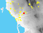 B04
Hora Zoodohos Piyi (2)
Periods Represented
(Byz-EMod)
Actual Area in Hectares
-
On-site Density (Sherds per Hecatare)
1.74
Ratio of On-site Density to Off-site Density
279
Collection Strategy
Tract material only.
Location and Description
On a narrow bulldozed terrace on the SE side of the Englianos ridge, about 1 km. NE of the Palace of Nestor, two chamber tombs are cut into the bedrock, their dromoi facing SE and separated from each other by c. 3.5 m.[095.20][113.24] Only the back of the chambers are preserved; the dromoi and front of the chambers were presumably destroyed when the terrace was bulldozed. The back walls of the chambers are preserved to a maximum height of 1.8 m., their floors to a max. depth of 1.3 m., and their ceilings to a max. depth of 0.6 m. Max. pres. W. of the chambers is 1.7 m.
Between the summers of 1993 and 1994 both tombs were excavated illegally; holes were dug into the chambers and a pile of backdirt lay in front of each.[095.18] No artifacts were found by us in this debris and none can be clearly associated with use of either tomb.
Intervisible Sites
-
Artifact Summary
The single body sherd collected from this site must be loosely dated to the period range Byz-EMod. The sherd is worn, with traces of white slip covered by green glaze on the interior.
References
-
All texts and images made available through The Pylos Regional Archaeological Project: Internet Edition are for personal use only. Reproduction of these materials without prior permission is prohibited.
Questions about the PRAP online database can be addressed to John Wallrodt at john.wallrodt@uc.edu.
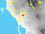 B05
Hora Palace of Nestor Chamber Tombs
Periods Represented
MH-LH, (MH III-LH II), (LH I-II), (LH IIIA-B)
Millstone: (HL)
Actual Area in Hectares
-
On-site Density (Sherds per Hecatare)
0.24
Ratio of On-site Density to Off-site Density
137
Collection Strategy
Tract material only.
Location and Description
In the rear scarp of an olive-covered terrace on the SE slope of the Englianos ridge, ca. 600 m. SW of the Palace of Nestor, two sets of cuttings are visible, each apparently the location of the filled and unexcavated dromos of a chamber tomb.
Both tombs were cut into the soft marl bedrock of the ridge. The dromos of Tomb A is roughly trapezoidal in section and is defined by two vertical cuttings that slope slightly towards each other.[113.25] The dromos is ca. 1.2 m. H., 0.8 m. W. at the bottom, and 0.7 m. W. at the top.
Tomb B lies 75 m. N of Tomb A in the scarp of the same terrace, and is defined by similar cuttings in the bedrock.[095.23] The preserved height of the dromos is 0.9 m.; it is 0.9 m. W. at the bottom, 0.8 m. W. at the top.
The dromoi of both tombs are oriented approx. NW-SE. Entrances would have faced the Vayies ridge. Small quantities of prehistoric pottery including Mycenaean fine wares were collected on the floor of the terrace near each of the tombs. An HL hopper millstone fragment was built into the rear wall of the terrace immediately above the tombs.
Intervisible Sites
-
Artifact Summary
Very few pieces. Tomb A produced only one, a late MH III-LH II body sherd.
References
-
All texts and images made available through The Pylos Regional Archaeological Project: Internet Edition are for personal use only. Reproduction of these materials without prior permission is prohibited.
Questions about the PRAP online database can be addressed to John Wallrodt at john.wallrodt@uc.edu.
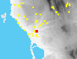 B06
Koryfasio Pisaski
Periods Represented
(Byz), Ott, EMod, Mod
Tile: EMod
grinding stone: (LH)
Max Dimension
35 m. (N-S) x 60 m. (E-W)
Actual Area in Hectares
0.13 ha.
On-site Density (Sherds per Hecatare)
1.97
Ratio of On-site Density to Off-site Density
867
Collection Strategy
Total (T) => Grid (G 10 m.)
Location and Description
Site B6 is located at the SW end of the Englianos ridge, about 1 km. N of the modern town of Koryfasio, and 600 m. NW of Pisaski village.[113.29] Artifacts are concentrated on a wide bulldozed marl terrace, covered with mature olive trees, and bordered both N and S by high bulldozed scarps; the site extends a short distance W onto a second, slightly lower, terrace. The edges of the terraces are very overgrown with weeds, but visibility is good within the fields.
Turkish-Early Modern sherds were found mainly near the center of the site; elsewhere, pottery was of Modern date. A single fragment of an LH quern may have been scavenged and brought here from elsewhere.
McDonald and Hope Simpson described remains of a possible Turkish inn on a hill to the E of Site B6, where they also hypothesized the existence of Mycenaean tombs.
Intervisible Sites
Tragana Alafinorema (C1); Tragana Voroulia (C3); Tragana Hasanaga (C4); Bay of Navarino
Artifact Summary
This site and its associated tracts contain mostly Early Modern roof tile fragments (over 90% of collected material). The few diagnostic fine wares date from the Turkish-Early Modern periods. Coarse wares, including fragments of "Koroneika" ware, are associated with the Early Modern period. Small finds correspond with this dating.
References
-
All texts and images made available through The Pylos Regional Archaeological Project: Internet Edition are for personal use only. Reproduction of these materials without prior permission is prohibited.
Questions about the PRAP online database can be addressed to John Wallrodt at john.wallrodt@uc.edu.
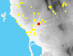 B07
Hora Palace of Nestor Lower Town
Periods Represented
(N?), (EH III?), MH, LH I-II, LH IIIA-B, (LH IIIC?), DA, G, C-HL, (Byz), (Ott?), EMod, Mod
Max Dimension
1000 m. (SW-NE) x 300 m. (SE-NW)
Actual Area in Hectares
18 ha.
On-site Density (Sherds per Hecatare)
1.84
Ratio of On-site Density to Off-site Density
1065
Collection Strategy
Total (T) => Grid (G 20 m.)
Location and Description
The so-called Palace of Nestor lies ca. 3 km SW of Hora. It is situated on the highest point of the Ano Englianos ridge[015.04][094.33][094.30], with excellent views SW to the coast[096.21] and NE inland. Because of its location, it is also visible from almost any high ground to the N, E, and S and can even be picked out from the site of ancient Koryphasion by Voidokoilia Bay.[015.23]
The results of excavation by Blegen of the central palatial structures, commencing in 1939, have been extensively published (PoN I-II). More recently, cleaning of the site as part of the preparation of a final site plan under the overall direction of Professor F. Cooper has produced further information regarding architectural phasing (annual reports in JHS-AR). In addition to excavation of the central palatial structures, Blegen also carried out tests in what he termed the 'Lower Town' (PoN III: 47-68), and excavated burial structures within the immediate vicinity of the palace: a large tholos tomb (Tholos IV; PoN III: 95-134) ca. 170 m. to the NE, an enigmatic structure termed by him the "Grave Circle" (probably another tholos tomb) 200 m. to the SW (PoN III: 134-76]), and a group of chamber tomb ca. 250-450 m. WSW (PoN III: 176-215).
PRAP has confined its investigation of the site to the surface remains outside the fenced area, including all those areas explored by Blegen. In particular, we carried out systematic tract-walking along the entirety of the Englianos ridge in 1992 to determine the probable maximum extent of the prehistoric settlement. Subsequently - in 1993 and 1994 - we collected artifacts on a 20-m. grid in those areas defined as most dense by tract-walking. This grid, comprising 474 squares, was divided into four quadrants, using the modern asphalt road as the division between N and S. Quadrant 1, therefore, lies NE of the palace; Q2 E and SE; Q3 (the smallest) SW; and Q4 (the largest) W and NW. Finally, on the basis of densities observed in the course of the grid collection, we carried out magnetometry[096.26] and resistivity[096.30] surveys in 1994 and 1995 primarily on the terraces W and SW of the palace structure - the area of Blegen's Lower Town and quite some distance beyond.
As a result of these investigations, we can say that the settlement surrounding the palace was much larger than previously estimated, perhaps 18 ha. (cf. UMME #1: 6.5 ha. minimum), bringing the total area of the site - including the palatial structures - to ca. 21 ha. We can also demonstrate the existence of material within that area extending from the EH/MH transition (notably in Q4) to LHIIIB as well as some PG and a small quantity of later material. The area of Q4 also yielded three fragmentary figurines (two human, one animal), numerous fragments of painted plaster, at least 7 loomweights and a spindle whorl.
Magnetometry and resistivity have produced encouraging results, suggesting the existence of a substantial linear feature some distance outside the modern fence to the W of the palace itself.
Two limestone blocks, spolia from the palace, were observed at site B1 ca. 2.5 km distant to the NE[003.09] and have been transferred to the palace site.
Intervisible Sites
-
Artifact Summary
The pottery from the town around the palace of Nestor is plentiful, and prehistoric material is heavily predominant. The earliest material dates to the transition from EH to MH, and the rest of the Bronze Age is well represented from MH through LH IIIB. There may be a small Dark Age presence, but thereafter only a few isolated sherds represent the Geometric through Early Modern periods.
The Late Mycenaean material has all the characteristics of local settlement pottery, as observed at Nichoria in Eastern Messenia as well as in the palace itself. Open shapes are more common than closed, fine than coarse, and unpainted than painted. Paint is fugitive in any case. Only two fabrics can be dated with some confidence to specific periods: a dark pink fabric is characteristic of LH IIIA, and in LH IIIB a soft, greenish-white-yellow fabric (2.5Y 8/1-8/2, 5Y 8/1-8/2) is common enough at the palace of Nestor to merit the epithet "palace ware."
References
PoN I-III; UMME #1; PHSP1: 237-238; PHSP3: 147-148 [42]; JHS-AR
All texts and images made available through The Pylos Regional Archaeological Project: Internet Edition are for personal use only. Reproduction of these materials without prior permission is prohibited.
Questions about the PRAP online database can be addressed to John Wallrodt at john.wallrodt@uc.edu.
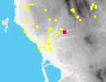 B08
Hora Triandafyllies
Periods Represented
(Mod)
Max Dimension
35 m. (N-S) x 60 m. (E-W)
Actual Area in Hectares
0.13 ha.
On-site Density (Sherds per Hecatare)
1.99
Ratio of On-site Density to Off-site Density
145
Collection Strategy
Tract material only.
Location and Description
Parts of two chamber tombs have been destroyed by the bulldozing of terraces for olive cultivation between switchback turns in the Hora-Myrsinohori asphalt road, E of Koukouyera, where the road descends into a deep valley separating the uplands S of Hora (Triandafyllies) from the Vayies ridge NW of Myrsinohori.
Only the back of the chamber of Tomb A is preserved (1.75 m. H. x 1.5 m. W. by 1.5 m. deep).[113.03][094.34] The front of the chamber and the dromos of the tomb were destroyed when the terraces were cut (not recently since they support mature olive trees).
Tomb B lies lower down the slope to the south, at the end of a small spur that projects SE; a bulldozer cut around the end of the spur has cut the tomb in two and only its back part has been preserved. It is covered today with slope debris and brush.[094.35]
No artifacts can be clearly associated with the use of either tomb. Pottery collected in the vicinity of the tombs was of modern date.
Intervisible Sites
-
Artifact Summary
This site contained one modern sherd and two modern tiles.
References
-
All texts and images made available through The Pylos Regional Archaeological Project: Internet Edition are for personal use only. Reproduction of these materials without prior permission is prohibited.
Questions about the PRAP online database can be addressed to John Wallrodt at john.wallrodt@uc.edu.
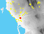 C01
Tragana Alafinorema
Periods Represented
MH-LH, (A-C), (C), C-HL, (R), R-Byz, Byz, Byz-Ott, Ott-EMod, EMod, Mod
Max Dimension
90 m. (NW-SE) x 110 m. (SW-NE)
Actual Area in Hectares
0.37 ha.
On-site Density (Sherds per Hecatare)
24.59
Ratio of On-site Density to Off-site Density
3340
Collection Strategy
Total (T) Grid (G 10 m.)
Location and Description
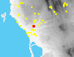
Site C1 is located on the terraced E and S slopes of a marl spur some 700 m. ENE of the modern village of Tragana[088.30]. A mound at the crest of the spur marks the northern end of the site; dirt roads bound it to the SE and SW. There is an excellent view of the Alafinorema valley, to the NE. Younger olives are interspersed with older mature trees.[093.34]
The mound is covered by brambles and weeds and a rubble terrace wall supports it at the S.[093.33] At the time of gridded collection of the site in 1992 virtually all artifacts were collected from the slopes beneath the mound. Between the summers of 1992 and 1993, however, a part of the mound covered with inpenetrable maquis was deep-plowed and levelled to create a short terrace at its SW side. In the process, many artifacts were brought to the surface on and near the mound itself, thus suggesting the possibility that artifacts on the slopes have eroded from this source.
This hypothesis is not contradicted by the results of follow-up geological investigations in 1993. Five cores were extracted perpendicular to the slope at 10 m. intervals. In a core taken in the mound N of the rubble wall, a buried soil unit with a noticeable anthropogenic impact, but containing few diagnostic artifacts, was reached at a depth of 0.7-1.3 m. This unit could not be traced in adjacent cores. In the area of the mound at least, it is clear, however, that soil creep has concealed part of the site.
Sherds identified as prehistoric or archaic-classical came largely from the northern edge of the site, on and around the mound, but some were also collected 30-40 m. downslope. In contrast, Byzantine - Turkish sherds, including cookwares, were found almost everywhere on the site.
Intervisible Sites
Tragana Hasanaga (C4); Koryfasio Pisaski (B6); PG tholos tomb and Chamber Tomb K-2 (see PoN III: 224-42).
Artifact Summary
Although some early sherds were collected at this site, the predominant range of ceramics at Alafinorema is Turkish-Early Modern. This reading is based on the large number of glazed tablewares from this period as well as plain and coarse wares. Earlier periods, however, are represented, including: MH-LH, Archaic-Classical, and Roman-Byzantine. These earlier diagnostic sherds are but a small proportion of the ceramics collected at this site. Sherds identified as prehistoric or Archaic-Classical came from the northern edge of the site and [from grid square 212]. Byzantine-Turkish sherds were more universally distributed across the site. Vessel types included true Classical fine wares (such as C92-91143-1), Byzantine table wares (such as C92-91312-1), and Early Modern glazed vessels. Cookwares were also widespread.
References
In AD 1969: 144; 1970: 182 were reported finds from Kato Englianos Elafina , including scattered blocks, R tile, LR pottery, an LR pithos burial, and a scatter of tile 500 m. NE of the pithos burial, where tile-graves had been found many years earlier. The precise location of the findspots of these artifacts relative to Site C1 is unclear.
All texts and images made available through The Pylos Regional Archaeological Project: Internet Edition are for personal use only. Reproduction of these materials without prior permission is prohibited.
Questions about the PRAP online database can be addressed to John Wallrodt at john.wallrodt@uc.edu.
 C02
Tragana Aladina
Periods Represented
(MHIII-LH II), A-C, (C?), C-HL, HL?, R?, Mod
Tile: A-HL
Max Dimension
35 m. (NE-SW) x 65 m. (NW-SE)
Actual Area in Hectares
0.17 ha.
On-site Density (Sherds per Hecatare)
15.46
Ratio of On-site Density to Off-site Density
228
Collection Strategy
Total (T) => Grid (G 10 m.)
Location and Description
Site C2 is located on a small spur overlooking the Alafinorema valley, ca. 1.7 km. NNE of Tragana and ca. 3.5 km. SW of Ambelofyto.[094.28] The spur is covered with olives, planted on bulldozed terraces and unterraced slopes; at the NE is an overgrown bulldozer track. The location affords panoramic views up and down the valley.[094.30]
Artifacts are concentrated on the western side of the spur, on a relatively gentle slope. S and E of the site, the spur drops steeply to the valley floor.
The site was first investigated in 1992. Subsequently the fields were plowed, and numerous fragments of tile were observed here in 1995.
Intervisible Sites
Hora Palace of Nestor (B7); Koryfasio Pisaski (B6); Hora Kato Englianos (C5); Hora
Artifact Summary
Ceramic material from Aladina was not fully collected. All diagnostic pottery was brought in for study but most of the tile was counted and left in the field. The site produced very little pottery, most of which was undiagnostic body sherds. The preservation of the material was poor, most sherds being small and worn. There are several clean joins across grid squares, however, implying recent disturbance of the area. In general the fabrics are soft and chalky, which probably contributes to their abraded appearance. The range of the pottery is Middle Helladic III-Late Helladic II (1 sherd) to Modern. Aside from Modern, the clearest period of activity at this site is in the Hellenistic or possibly Classical period. Fine wares, plain wares and cooking wares were collected, as well as a loomweight and glazed roof tiles. This combination suggests a domestic context.
The tile collected from the site falls into three categories, one of which is clearly Modern. Another type of tile has a dense pink fabric and often retains traces of glaze, and the other is a heavier orange fabric. It is not possible, however, to determine the relative proportion of these tile types at the site due to the fact that most tile was not collected. For example, in square 111, the field tile count was 1042 fragments, but only 50 of these were collected for study.
References
-
All texts and images made available through The Pylos Regional Archaeological Project: Internet Edition are for personal use only. Reproduction of these materials without prior permission is prohibited.
Questions about the PRAP online database can be addressed to John Wallrodt at john.wallrodt@uc.edu.
 C03
Tragana Voroulia
Periods Represented
MH, MH-LH, (LH I-IIA), (LH IIIA), LH
Max Dimension
20 m. (N-S) x 25 m. (E-W)
Actual Area in Hectares
0.03 ha.
On-site Density (Sherds per Hecatare)
0.30
Ratio of On-site Density to Off-site Density
2
Collection Strategy
Total (T) Grid (G 10 m.)
Location and Description
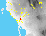
In 1956 Marinatos excavated at Voroulia a small room, apparently once part of a larger structure. The site lies on the slopes of the Tragana ridge, in an olive grove near a large modern whitewashed villa some 300 m. NNE of Tragana village.[088.30][107.21] A few scraps of the walls uncovered by Marinatos can still be seen in the NE part of the site, next to the Tragana-Ambelofyto road.[101.32]
Artifacts are concentrated within a small area on the first three terraces below (to the E of) the road. The terraces are covered with weeds and planted with both young and mature olives, and in places are supported by stone walls. There are no surface indications that the complex explored by Marinatos was very large. Pottery from contiguous off-site tracts is sparse, and diagnostic pieces are of much later date (Byz-Mod).
Intervisible Sites
Hora Palace of Nestor (B7); Koryfasio Pisaski
Artifact Summary
The small amount of pottery collected from this site ranges in date from Middle Helladic to LH IIIA. Few pieces are diagnostic; the rest are dated by fabric alone. The site is discrete and well-defined; pottery from contiguous off-site tracts is sparse, and diagnostic pieces are of much later date (Byzantine-Modern).
References
UMME #12; PHSP1: 239-240 [45]; Ergon (1956) 90; Prakt (1956) 202; (1976) 253, 271-81; Lolos 1987: 60-95.
All texts and images made available through The Pylos Regional Archaeological Project: Internet Edition are for personal use only. Reproduction of these materials without prior permission is prohibited.
Questions about the PRAP online database can be addressed to John Wallrodt at john.wallrodt@uc.edu.
 C04
Tragana Hasanaga
Periods Represented
(ER), (Ott), EMod
Max Dimension
390 m. (NW-SE) x 210 m. (SW-NE)
Actual Area in Hectares
4.10 ha.
On-site Density (Sherds per Hecatare)
42.09
Ratio of On-site Density to Off-site Density
1821
Collection Strategy
Selection (S) => Micro-tract (M) => Vac. circle (VC)
Location and Description
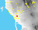
Site C4 consists of the marl hill of Hasanaga and its immediate vicinity[094.17][112.32], ca. 500 m. E of Tragana and ca. 900 m. NW of the outskirts of Koryfasio. Ottoman sources and travelers' accounts testify that there was a settlement here in the Early Modern period.
On the flat top of the hill are olive groves, a vineyard and overgrown fields; its slopes are covered mostly by maquis and olives on bulldozed terraces; on its lower slopes there are a few renegade vines. Most fields around the hill are planted in olives.
There are today three main complexes of architectural remains at Hasanaga: a house compound at the E foot of the hill, a chapel of Ayia Paraskevi with an enclosure wall N of the hill, and the remains of walls on the top of the hill itself.
At the eastern foot of the hill is a two-storey, plastered mudbrick house, seasonally occupied and in good repair; it has elevated, second floor doorways on its N, S, and W sides.[094.02] Next to the N door are two holes in the mudbrick that possibly were made to support a ladder. The S door is walled shut with air brick. Below it is a small outdoor shed, used for cooking. A modern iron stairway ascends to the W door.
There are foundations of an older house immediately E of the modern house.
[094.07] The SE corner of the older building is preserved to a height of ca. 1.5 m.; it is built with headers and stretchers of medium-sized cut blocks and a fragment from a Koroneï ka-type pithos is incorporated in it.
[094.09] Two niches ca. 1.5 m. above present ground level in the W wall of the house are probably for storage cupboards.
S of the older and the modern house is a rectangular yard, enclosed by a narrow wall, built of small, mortared limestone blocks and capped by a bevelled mortar moulding.[094.10] Two stages of construction can be recognized in the walls of the enclosure. Its W and N walls and SW corner represent a rebuilding of the original enclosure, characterized by lines drawn with fingers in mortar.
Most of the S wall and all of the E wall appear to be parts of the original construction. The SW corner is built with headers and stretchers of cut blocks. In the center of the S enclosure wall are seven holes, possibly gun slits, unevenly spaced and at differing elevations (all ca. 1.5 m. above modern ground level). Within the enclosure are three extremely old olive trees.
The building history of the complex is clear. First the older house was built, an enclosure wall with bevelled moulding defined its yard, the modern house replaced it, and the enclosure wall was rebuilt.
The chapel of Ayia Paraskevi is N of the hill of Hasanaga.[094.11] A whitewashed concrete cross (with rusticated sides) stands in the churchyard. The interior of the church is paved with stone slabs. Two stages in construction of the building can be recognized. Since the church was first built, ca. 0.6 m. of eroded soil has accumulated against its S and W walls. New windows have been inserted in these walls at a higher elevation than the original windows, and a forecourt outside its main door on the W has been dug into the colluvium to permit free access.
To the W, N and probably E, the churchyard is enclosed by walls similar in construction to those that enclose the yard of the house on the E side of the hill. The best preserved portions of this enclosure are W and N of the church; only a corner of the E wall is preserved. To the W, a new gateway into the churchyard has been inserted into the earlier wall. A bell hangs in a tree next to the entrance; on it is written the name of the church, the date 1897, and images of Ayios Yeoryios and the Virgin.
Artifact densities at Hasanaga are highest on top of the hill, especially in an olive grove at its eastern edge. There are many field walls built of stone and tile there, probably constructed from the collapsed remains of buildings that once covered the area. Some walls are mortared and may be the remains of structures belonging to the settlement of Hasanaga. In a very weedy field there is one apsidal wall.
At the S edge of the top of the hill, cuttings (0.4 m. w. x 0.15 m. deep) in a sloping, smoothed area of bedrock are probably the remains of a water channel, but may be bedding trenches for walls.
The top of the hill, especially its E side, is surrounded by a wall, largely hidden by maquis and bamboo. This wall has effectively retained archaeological deposits on top of the hill; few artifacts are found on its slopes. On the E slope, however, is a large stone olive press (0.95 m. in diameter). There are at least two other presses nearby: one 250 m. NNW of eastern house complex, the other 400 m. to the NW.
Intervisible Sites
(These sites are visible from the two-storey house at C4.) Hora Palace of Nestor (B7); Tragana Alafinorema (C1); Koryfasio Pisaski (B6); PG tholos tomb and Chamber Tomb K-2 (see PoN III: 224-42); Koryfasio
(from the hilltop at C4): Tragana Voroulia (C3); Koryfasio Beylerbey (I1); Koryfasio Portes (I5); Koryfasio; Bay of Navarino
Artifact Summary
The diagnostic pottery is primarily 18th-19th century in date. This material is concentrated along the property wall [in grid square 0483], where the press was found, and [in grid square 0021 to the south]. The vicinity of the Turkish building contained only 4 Turkish-Modern tiles and one undatable sherd.
References
F. Sauerwein, "Das Siedlungsbild der Peloponnes um das Jahr 1700. Mit einer Karte und einem Ortsverzeichnis," Erdkunde 23 (1969): Ortsverzeichnis/Navarino [18]; W. Gell, Narrative of a Journey in the Morea (London 1823 ) 61; Expedition scientifique de Moré e I (Paris 1836) 156, 158.
All texts and images made available through The Pylos Regional Archaeological Project: Internet Edition are for personal use only. Reproduction of these materials without prior permission is prohibited.
Questions about the PRAP online database can be addressed to John Wallrodt at john.wallrodt@uc.edu.
 C05
Hora Kato Englianos
Periods Represented
(PoN III) LH II, LH IIIB
Max Dimension
(PoN III) 7.66-7.71 m. (D. chamber); 8.10 m. (L. dromos); 2.35-2.25 m. (W. dromos)
Actual Area in Hectares
-
On-site Density (Sherds per Hecatare)
1.74
Ratio of On-site Density to Off-site Density
367
Collection Strategy
Not collected as a site
Location and Description
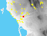
The Kato Englianos tholos [094.20], excavated by Blegen (PoN III: 73-95 [Tholos III]), sits on the crest of the Kato Englianos ridge[094.30], approximately 900 m. SW of the Palace of Nestor. At the NNE edge of the tholos, a modern well, associated with an adjacent fieldhouse, was inserted into the chamber of the tomb before it was excavated. The fieldhouse originally stood over the tomb, but was rebuilt by Blegen. Many of its blocks appear to have been robbed from the tholos. The dromos of the tomb faces S, and is covered with maquis at its southern end. The tomb is otherwise surrounded by a field of weedy olives. The tomb had been extensively plundered, but finds included gold, faience, glasspaste, ivory and amber, as well as a Syro-Palestinian amphora bearing an incised mark. Intensive tract-walking by our team in the vicinity of the tomb (Tracts C-92-118/119) produced no significant additional finds, other than some generally MH-LH pottery.
Intervisible Sites
Tragana Voroulia (C3) (along the line of the dromos); Petrohori; Bay of Navarino.
Artifact Summary
References
PoN III: 73-95; UMME #1
All texts and images made available through The Pylos Regional Archaeological Project: Internet Edition are for personal use only. Reproduction of these materials without prior permission is prohibited.
Questions about the PRAP online database can be addressed to John Wallrodt at john.wallrodt@uc.edu.
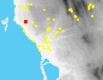 D01
Gargaliani Kanalos
Periods Represented
N, (EH), MH, LH I-II, LH IIIA-B, PG, G-A, (A-CL), HL, R, Byz, EMod, Mod
Tile: HL, Byz-Turk?, EMod, Mod
Max Dimension
130 m. (N-S) x 85 m. (E-W)
Actual Area in Hectares
0.45ha.
On-site Density (Sherds per Hecatare)
3.62
Ratio of On-site Density to Off-site Density
1378
Collection Strategy
Total (T) Grid (G 10 m.)
Location and Description
The center of the site of Kanalos is located ca. 3 km. E of Marathopolis on a low tongue-shaped ridge, or interfluve, that extends SW from the foothills overlooking the coastal plain of Dialiskari from the east; the interfluve is defined by two streams that join west of the ridge and flow from there to the coast at Dialiskari.[018.14] Immediately west of Kanalos the bed of the stream is deeply incised and narrow; near the coast it becomes broader and more shallow.
McDonald and Hope Simpson first described archaeological remains at Kanalos in 1961, including traces of ancient walls (?prehistoric fortifications), "several good squared, hammer-dressed poros blocks" (?from a late C-HL temple), and pottery of both prehistoric and historic date. 400 m. to the southeast they also described the remains of a burial mound; in 1982 MH and LH pottery was recovered when a second nearby mound was bulldozed.
On the SW the ridge is steep; at its foot is a small spring, surrounded by bamboo and reeds. We were told in 1993 that the spring ran only in the winter, but we observed running water there in summer 1995. McDonald and Hope Simpson reported Turkish brickwork surrounding the spring but no traces of it remain. To the S and W, the ridge drops precipitously down maquis-covered slopes to flat fields currently used as gardens. To the N and east, it descends more gently into olive groves. There is a cypress forest immediately NE.
The ridge consists of two flat-topped knolls, separated by a small saddle. On the northern, higher knoll there are many tile fragments on and around a roughly circular mound of earth. At the E side of this knoll, on a terrace, is a line of stones (perhaps a wall), oriented NE-SW and ca. 45 m. in length; ca. 15 m. to the NW of its N end are stones that might belong to another wall preserved 6-7 m. in length and oriented E-W. Immediately N of it a truncated wall is visible in the bulldozed N scarp of the knoll. From the scarp we collected large quantities of fine pottery; on the surface of the knoll around the remains of the walls there was little but fragments of tile.
McDonald and Hope Simpson (PHSP1: 237 [38]) reported remains of a possible "temple" on the northern knoll. We found at least three ashlar blocks (0.5 m. x 1.7 m.; 0.5 m. x 0.5 m. x 0.4 m.; 0.65 x 0.65 m. x 1.08 m.) that may belong to a monumental structure: one at the NE edge of the knoll, one at the NW edge, a third on the NW slope.
[034.08] There has been considerable bulldozing in this part of the ridge since McDonald and Hope Simpson visited.
At the western edge of the saddle between the two knolls there are many large boulders, presumably part of the "Cyclopean" wall indicated by McDonald and Hope Simpson [PHSP1: 236, ill. 7]) on their sketch plan of the site. We are not certain, however, if these boulders actually belong to a wall or are part of a natural geological formation.[023.07] The boulders may, in part, have been piled into a natural v-shaped hollow to support a terrace to the E.[023.05]
On top of the southern knoll there are three rock cut tombs (c. 0.5 m. x 1.88 m. x 0.48 m. deep; 0.70 m. x 1.4 m.; 0.75 x 1.75 m.), each oriented in a different direction (300 degrees , 360 degrees , and 200 degrees).[018.15] A tile grave with human bones was visible in the very eroded E scarp of this knoll in 1993.[018.25]
An area of approx. 0.75 ha. was gridded in 1993, encompassing both knolls, their slopes, and the saddle between them. Tract-walking suggests that the site is substantially larger than this area, but our request to continue work in 1994 was denied by the Greek Archaeological Service.
Antiquities at Kanalos are at considerable risk of destruction. Between summer 1992 and summer 1993, several holes were dug on the top of the southern knoll, apparently by antiquities robbers. In 1995 we found no new signs of looting, but the site had been substantially modified in other ways. A gravelled road now leads to the spring, and the SW end of the ridge has been bulldozed. A channel for irrigation pipes (up to 1 m. deep) was dug through fields that border the ridge on the east.[110.01]
There were new irrigated gardens in the valley W of the ridge. Scarps in the N and SE eroded further, and many ancient artifacts were visible in them. At the E edge of the southern knoll was a large hole, perhaps the remains of another grave, the roof of which has collapsed.
Intervisible Sites
-
Artifact Summary
Study of the material from this site is still in progress. Pottery ranges in date from MH to Modern, but only a few pieces have so far been catalogued.
References
UMME 15; PHSP1: 236-37 [38]; ADelt (1982) 135
All texts and images made available through The Pylos Regional Archaeological Project: Internet Edition are for personal use only. Reproduction of these materials without prior permission is prohibited.
Questions about the PRAP online database can be addressed to John Wallrodt at john.wallrodt@uc.edu.
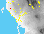 D02
Gargaliani Megas Kambos (1)
Periods Represented
(N), (EH-MH), MH III-LH II, LH I-II, LH IIIA-B, (G), (G-A), (A-HL), (HL-R), R, (Byz), EMod, Mod
Tile: HL-R, later
Max Dimension
225 m. (N-S) x 160 m. (E-W)
Actual Area in Hectares
1.62 ha.
On-site Density (Sherds per Hecatare)
2.16
Ratio of On-site Density to Off-site Density
897 per ha.
Collection Strategy
Total (T) => Grid (G 20 m.)
Location and Description
The site lies on an elongated (NW-SE) rise with a trigonometric point (104 masl.) ca. 3 km. E of Marathopolis[090.19]. The rise is part of a series of knolls on the coastal plain below (W of) the modern town of Gargaliani[098.35]. The rise slopes gradually to the N, S and W, with a more abrupt drop to the NE. The top is largely covered with maquis, dissected by goat paths, with some open grassy areas. The N and NW slopes are currently planted with grassy mature olives and there are occasional outcrops of bedrock. Intensive market gardening is being practiced on the E side of the hill. The S knoll has many exposed rock outcrops interspersed with grassy areas; at the bottom of the slope are extensive olive groves. On the SE slope is a bedrock cutting consisting of a vertical face with two short returns (perhaps a quarry)[090.14]. Although the elevation is slight in absolute terms, visibility from the site is good, particularly to the W, E, and S [090.16]
Material on the site divides into two distinct phases: PR (particularly LH I-II and LH IIIA-B) and A-R. PR material was identified in all four quadrants, whereas A-R artifacts predominate in the S part of the low ridge (Q2). A significant PR find was a shaft-hole hammer axe of probable MH I date. Since 1994, significant bulldozing and brush clearance has taken place along the southern boundary of the site (along and above the line where the ridge meets the flatter contours of olive fields)[090.11].
Whole trees have been uprooted at the SE edge of the site, closest to the encroaching market gardens. Many potsherds and tile fragments can now be seen here, suggesting that further collection of the site would produce appreciably higher densities in this area than in 1994.
Intervisible Sites
Gargaliani Kanalos (D1); Gargaliani Megas Kambos (2) (D3); Marathopolis Dialiskari (G1); Marathopolis; Proti; Profitis Elias (Petrohori)
Artifact Summary
Prehistoric material is dispersed over all the site, with very few diagnostic pieces in any one area. Geometric-Roman material is chiefly concentrated [in the second quadrant]; again there are few good shapes but much tile, including glazed pieces.
References
-
All texts and images made available through The Pylos Regional Archaeological Project: Internet Edition are for personal use only. Reproduction of these materials without prior permission is prohibited.
Questions about the PRAP online database can be addressed to John Wallrodt at john.wallrodt@uc.edu.
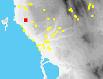 D03
Gargaliani Megas Kambos (2)
Periods Represented
MH-LH, LH IIIB, C-HL, HL, HL-R, ER, MR?, LR, Ott-EMod, EMod
Max Dimension
55 m. (E-W) x 70 m. (N-S)
Actual Area in Hectares
0.24 ha.
On-site Density (Sherds per Hecatare)
26.98
Ratio of On-site Density to Off-site Density
6349
Collection Strategy
Selection (S) => Grid (G 10 m.)
Location and Description
Site D3 is located ca. 300 m. NE of the knoll of Megas Kambos [D2], within an olive grove on a gentle SW slope. Young trees were planted in 1994/95 in regularly spaced rows between irregularly spaced mature olives.[090.07] There is a line of maquis ca. 5-10 m. from the eastern boundary of the site; artifact densities were highest to the W of it. At the base of some of the older olives there are piles of roughly worked stones, perhaps from collapsed structures.
At the center of the site are two mounds of stone rubble and artifacts, separated by ca. 20 m. The southernmost is ca. 6 m. in diameter[107.27] and 0.5 m. high; the northernmost, ca. 20 m. x 2-3 m. x 1 m. high.[090.10] It is possible that both mounds are remnants of a larger artificial mound which has been largely bulldozed away. In a roughly oval area that includes the two mounds there are no older olives, leading us to hypothesize that there may have been a large maquis-covered mound here that until recently hindered cultivation.
Intervisible Sites
Gargaliani Megas Kambos (1) (D2)
Artifact Summary
The site of Megas Kambos (2) produced large quantities of both pottery and tile. No clear pattern emerges from the distribution of pottery and tile at the site. The pottery collected ranges in date from Middle-Late Helladic to Modern. The prehistoric pottery is limited in number, consisting of several Middle-Late Helladic coarse ware bodies and two Late Helladic diagnostic sherds. The Turkish-Early Modern period also has a limited but clear representation at the site. The primary period of occupation appears to be Hellenistic to Roman in date. The Late Hellenistic-Early Roman pottery includes many fine wares such as examples of West Slope Ware and Eastern Sigillata A.
References
-
All texts and images made available through The Pylos Regional Archaeological Project: Internet Edition are for personal use only. Reproduction of these materials without prior permission is prohibited.
Questions about the PRAP online database can be addressed to John Wallrodt at john.wallrodt@uc.edu.
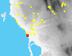 E01
Romanou Glyfadaki
Periods Represented
G?, A, (C), HL, Late HL, (EMod)
Actual Area in Hectares
0.39 ha.
On-site Density (Sherds per Hecatare)
7.27
Ratio of On-site Density to Off-site Density
855
Collection Strategy
Total (T) => Grid (G 10 m.)
Location and Description
Site E1 is located 1 km. SW of the modern town of Romanou and 250 m. E of the beach at Bouka. The site is centered on a low knoll, amidst dunes; artifacts are mostly associated with a very sandy red soil. The northern part of the site is covered by a weedy vineyard[096.03][114.12]; a fallow field comprises its southern part.[096.04] A low rubble wall, covered with brambles, separates the fields; some artifacts were found built into it.
Magnetometric investigations detected the buried remains of a single large building (more than 40 m. in its extent). Cores taken from several holes drilled into the magnetic anomalies suggest, however, that the walls of the building themselves are not preserved, only their bedding trenches.
Almost all of the pottery and tile collected at Site E1 appears to date to the Late Hellenistic period and to derive from a domestic assemblage. Surface densities of both pottery and tile are highest in areas where geophysical investigations discovered magnetic anomalies.
Intervisible Sites
Hora Palace of Nestor (B7); Vromoneri Ayia Sotira (G2); Profitis Elias/Petrohori
Artifact Summary
The bulk of the pottery and tile collected from this site appears to represent a primarily Late Hellenistic domestic assemblage. Several fragments of Archaic pottery and three which could be as early as Geometric also were found at the site. The collected pottery and tile correlate with anomalies detected through geophysical work.
References
-
All texts and images made available through The Pylos Regional Archaeological Project: Internet Edition are for personal use only. Reproduction of these materials without prior permission is prohibited.
Questions about the PRAP online database can be addressed to John Wallrodt at john.wallrodt@uc.edu.
 G01
Marathopolis Dialiskari
Periods Represented
HL, ER, MR, LR, (Byz?), (Ott?), EMod, Mod
Max Dimension
1000 m. NW/SE x 600 m. NE/SW
Actual Area in Hectares
34.90 ha.
On-site Density (Sherds per Hecatare)
9.92
Ratio of On-site Density to Off-site Density
938
Collection Strategy
Selection (S) => Micro-tract (M) => Vac. strip (VS)
Location and Description
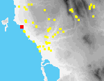
The church of Ayios Nikolaos is located on the coast, ca. 2.5 km. S of Marathopolis. Site G1 extends nearly a kilometer along the coast both N and S of the church and a maximum of 600 m. inland, bordered on the E by the modern asphalt road between Tragana and Marathopolis.[047.03]
Most of the site is relatively flat. Near the church, amidst old olive groves, are terraces with market-gardens; lines of reeds and maquis grow along their edges. The coast itself is rocky and barren. Development of beachfront properties is accelerating; the recent construction of several huge villas has done much damage to the site.[090.04] Fields near the asphalt road are mostly planted with olives; there are scattered modern houses (some with fenced compounds).
On the coast ca. 500 m. SE of Ayios Nikolaos there is a quarry. Immediately W of Ayios Nikolaos a large chunk of ancient walling abuts the south side of a small cinderblock building.
[049.01] NW of the church is a small bay, now used by fishing boats for anchorage.
[088.32] There are ancient cuttings
[042.10], probably salt pans, in the rocky promontory that closes the bay on the N. Farther N along the coast are possible quarries.
Valmin, UMME, and local scholars had previously noted ancient architectural features at Dialiskari; investigations by PRAP found others.
*Ca. 100 m. NW of Ayios Nikolaos, next to the dirt road leading to the church, is a modern house with ancient columns built into its veranda.[032.25] There is a fragment of a column E of the house, in its yard.
*Ca. 100 m. N of the previous house, there is a polygonal brick foundation, with at least four preserved sides.
*Part of a hypocaust with brick pillars and mortared walls can be seen in the scarp of a terrace immediately NW of the same house.[006.29] Geophysical investigations[098.16] demonstrated that the substructure of a Roman bath is preserved to the E, in the field adjacent to these remains.
*Ca. 300 m. NW of the house with the columns part of a Roman brick floor[049.19] and of a Roman mosaic[049.24] can be seen in the yard of another house.[022.17] Roman marble revetment[025.20] is preserved at the base of the W wall of this house, near its NW corner.
*Probably predating the Roman remains are poros blocks visible at the SW corner of the house.
*There are several unfluted monolithic columns and very large quantities of potsherds and tile in a fenced compound ca. 150 m. W of the house with the Roman mosaic.[006.31] We also found an inscription of the Early Roman period in the same location.
*There are seven rock-cut graves at the N end of the site, near the asphalt road.
Intervisible Sites
-
Artifact Summary
Nearly all the pottery collected from this site is Hellenistic-Roman in date. It comprises a full range of table wares, storage and cooking vessels.
References
UMME 406; Valmin 1930: 136-40; Prakt (1960) 193-4; Ergon (1960) 141-5; S. Liritzis, "H arhaia polis tis dytikis Messinias Erana," Platon 21 (1969) 152-80; D. Demakes, "Proti-Dialiskari," Messiniakon Etos (1938) 87-93.
All texts and images made available through The Pylos Regional Archaeological Project: Internet Edition are for personal use only. Reproduction of these materials without prior permission is prohibited.
Questions about the PRAP online database can be addressed to John Wallrodt at john.wallrodt@uc.edu.
 G02
Vromoneri Ayia Sotira
Periods Represented
HL, R, EMod, Mod
Max Dimension
350 m. (NE/SW) x 350 m. (NW/SE)
Actual Area in Hectares
6.50 ha.
On-site Density (Sherds per Hecatare)
0.77
Ratio of On-site Density to Off-site Density
13
Collection Strategy
Selection (S) => Micro-tract (M) => Vac. circle (VC)
Location and Description
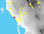
Site G2 is located ca. 1.2 km. S of Vromoneri, near the coast. It extends from high sea-cliffs at the W to a small hill ca. 500 hundred meters from the sea on the E. Much of the site is covered by weedy olive orchards. There are several occupied modern houses within it.
On top of the small hill are 13 rock-cut graves[073.02] and various other cuttings in the bedrock. In the field to the west there are several ashlar blocks.[073.01]
Approximately 150 m. to the SW of the graves, there is an abandoned two-storey house.[090.27][090.25] Its veranda is enclosed by a low wall with ornamental pillars; a bread-oven still stands next to the house. The basement is partly cut into bedrock. From the veranda there is an impressive view to the SE.
A wall with bevelled mortar moulding similar to those at Site G3 and Site C4 is attached to the wall of the house[090.28] and be traced for ca. 100 m.; it may once have continued to the coast and have been part of a large enclosure associated with the house. Near the site is a similar walled enclosure, its gateway preserved and there are other collapsed and collapsing walls of the same style in the vicinity.
Ca. 150 m. SW of the abandoned house and some 50 m. from the beach, there is a large buried structure of brick and mortar.[110.10] It appears to be divided into several compartments. It may have been a cistern, a storage facility, or even a catacomb. Diagnostic ceramic finds of the Hellenistic/Roman period cluster around this feature. Early Modern pottery was found all over the site.
The church of Ayia Sotira is located on the coast, several hundred meters north of Site G2. Valmin had previously reported architectural fragments in its vicinity.
Intervisible Sites
-
Artifact Summary
Most of the material collected at Ayia Sotira was too worn to date accurately, but the predominant periods represented are Hellenistic-Roman and Early Modern. Hellenistic and Roman finds include plain ware bowls and storage vessels, as well as possible Laconian tile fragments. Early Modern pottery is characterized by fine wares such as plates with blue flower designs.
References
Valmin 1930: 111 [Kalo Nero Ayia Sotira]
All texts and images made available through The Pylos Regional Archaeological Project: Internet Edition are for personal use only. Reproduction of these materials without prior permission is prohibited.
Questions about the PRAP online database can be addressed to John Wallrodt at john.wallrodt@uc.edu.
 G03
Vromoneri Pigadia
Periods Represented
MH III-LH II, MH-LH, LH IIIA-B, (HL), HL-R. (ER-MR), MR-LR, LR, (Byz), (Byz-Ott), (EMod), Mod
Tile: Ott-EMod, Mod
Max Dimension
330 m. (NE/SW) x 250 m. (NW/SE)
Actual Area in Hectares
7.20 ha.
On-site Density (Sherds per Hecatare)
16.11
Ratio of On-site Density to Off-site Density
859
Collection Strategy
Selection (S) Micro-tract (M) => Vac. circle (VC)
Location and Description
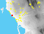
The site of Pigadia is located on the the crest and slopes of a low NW-SE ridge[110.08] approximately 600 m. N of the hamlet of Vromoneri, and is bisected by a dirt road that here crosses the ridge. Weedy olive groves cover much of the site; there are two new villas on the S side of the road. Artifacts were most plentiful S of these houses in and around several piles of rocks that had been cleared from adjacent fields; in the yards of the houses themselves; and immediately north of the houses, on both sides of the road.
In 1973-74 a farmer discovered in his field at Pigadia two pithoi that had been set intact into the ground and were covered with irregular limestone slabs; in the course of removing them, sherds of Mycenaean vessels were found (JHS-AR 1979-80:33; ADelt 1973-4:316). We have not been able to learn the precise location of this excavation but it seems probable that the pithoi were found near the new houses. In 1993 we were shown a fragment from a similar pithos that is now in possession of one of their owners.
At the northern end of the site, an old house is surrounded by an extensive wall that appears to enclose not only it, but an extensive area of cultivated fields in the vicinity; an arched gate leads through the wall to the house.[090.24] On the opposite side of the road, are preserved parts of a similar wall around a second old house; farther W, near the end of the the ridge, sections of yet another wall of similar construction can be seen. The walls in all cases are capped by a beveled concrete molding,[110.06] and are similar in style to others in the study area (e.g., at Tragana Hasanaga [C4] and Vromoneri Ayia Sotira [G2]).
Prehistoric material was mainly found in the field immediately SE of the modern houses, over an area of no more than 0.75 ha. Early Modern is concentrated around the modern houses. HL-R ceramics are in contrast found in all parts of the the site.
Intervisible Sites
Vromoneri; Gargaliani
Artifact Summary
The LH IIIA-B pottery is recognized by shapes (kylix, dipper); the MH III-LH (II) by its fabric (orange to brown with tan clay inclusions). Historical ceramics predominate, however, chiefly of Hellenistic-Roman and Early Modern date.
References
JHS-AR (1979-80) 33; AD (1973-74) 316
All texts and images made available through The Pylos Regional Archaeological Project: Internet Edition are for personal use only. Reproduction of these materials without prior permission is prohibited.
Questions about the PRAP online database can be addressed to John Wallrodt at john.wallrodt@uc.edu.
 I01
Koryfasio Beylerbey
Periods Represented
(N), MH, LH I-II, LH IIIA-B, (G), (A), (C), HL, R, Byz, (Ott?), EMod, Mod
Actual Area in Hectares
12 ha.
On-site Density (Sherds per Hecatare)
2.36
Ratio of On-site Density to Off-site Density
584
Collection Strategy
Total (T) => Grid (G 20 m.)
Location and Description
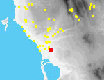
Beylerbey is a long ridge that rises ca. 15 m. above the coastal plain, ca. 700 m. S of the outskirts of the modern village of Koryfasio.[096.08][114.15] Site I1 is located on the northern of the two knolls that form the ridge[096.02].
Artifacts are most dense on the broad flat top of this knoll, but are also found on its slopes, and in the fields around it.
The northern knoll is bordered to the W and E by dirt roads, and on the N by a stream. In the NW, traces of an old stone roadway are visible in the bed of the modern road. On the top and slopes of the knoll there are several small field houses and a cement floor for drying currants. Almost the entire site is covered with mature olives; there are a few scattered almonds.
The site has been known for nearly a century. Skias reported a bronze sword from Beylerbey in the possession of a resident of Koryfasio in 1909. According to McDonald and Hope Simpson, tombs are supposed to have been found in the saddle between the two knolls, and probably on the E slope of the northern knoll where they also note walls, perhaps of houses. Pottery they themselves collected was mostly of LH IIIB date, with some possibly of LH II and LH IIIA. In test excavations, Marinatos found almost no architectural remains and excavated deposits were very shallow in depth, leading him to draw the conclusion that the site was small and insignificant.
Magnetometry and geological coring sponsored by PRAP also suggest that there are no substantial cultural deposits beneath the plow zone. Virtually all of the 28 augur cores extracted at Beylerbey reached bedrock at depths of 0.2-0.5 m. It seems clear that the entire site consists only of a thin veneer of soil and artifacts, resting on bedrock. This entire soil unit has been greatly disturbed by plowing. Magnetometry survey similarly did not succeed in identifying in situ subsurface architectural remains.
It is, however, also clear that the site was once very large and was a center for settlement in the area. Artifacts were collected by our teams in some 300 20 x 20 sq. m. grid squares. Preliminary analysis suggests that the site was inhabited in most prehistoric and historic periods.
Intervisible Sites
Tragana Voroulia (C3); Romanou Viglitsa (Tragana Tholos Tombs) (I6); Pyrgaki Tsouka (I19); Koryfasio Haratsari (Osmanaga Tholos) (I2); Koryfasio.
Artifact Summary
Study of material from this site is still in progress, and no pieces have yet been catalogued.
References
UMME 4; PHSP1: 242; PHSP3: 149 [56]; Prakt (1960) 197; AJA (1939) 559
All texts and images made available through The Pylos Regional Archaeological Project: Internet Edition are for personal use only. Reproduction of these materials without prior permission is prohibited.
Questions about the PRAP online database can be addressed to John Wallrodt at john.wallrodt@uc.edu.
 I02
Koryfasio Haratsari (Osmanaga Tholos)
Periods Represented
EH, MH-LH I, (LHI/II), (LCL-HL)
Max Dimension
6 m. (D. chamber)
Actual Area in Hectares
-
On-site Density (Sherds per Hecatare)
1.06
Ratio of On-site Density to Off-site Density
211
Collection Strategy
Tract collection only
Location and Description
The tholos tomb at Haratsari-first excavated by Kourouniotis in 1926 and published by Blegen thirty years later-is located in relatively flat olive groves some 700 m. SW of the outskirts of modern Koryfasio; the ground around the tomb is slightly higher than in adjacent fields. There are bamboo and tall grass around the tomb[096.20]. When we first visited the site in 1991, both its dromos and chamber had been cleared, and they remained so in 1994; by 1995, however, the dromos had been filled with soil eroded from the adjacent olive groves, and about half the floor of the chamber was covered with colluvium. Recently, Korres and Lolos have reexamined the material, confirming the early date of the finds that indicate it is one of-if not the-earliest tholos tombs on mainland Greece (Korres 1981-82: 378-81; Lolos 1989). Korres identifies three phases in the tomb material, although it is difficult to assign them specific contexts: EH (from an underlying settlement); late MH-LH I/II; and LCL-HL reuse, possibly associated with cult. No finds of significance were made in the vicinity in the course of PRAP's tract-walking.
Intervisible Sites
Tragana Voroulia (C3)
Artifact Summary
Four sherds were collected from this site: two Modern, two undatable.
References
UMME 5; PHSP1: 242 [57]; Lolos 1987: 172-78; Prakt (1925-6) 140-41; (1976) 270-71; (1977) 230-33; AJA (1939) 557; Hesperia 23 (1954) 158-62; Korres 1981-82: 378-81; Lolos 1987: 172-78; Lolos 1989; Alcock 1991: 466 [#27]; Antonaccio 1995: 72-73
All texts and images made available through The Pylos Regional Archaeological Project: Internet Edition are for personal use only. Reproduction of these materials without prior permission is prohibited.
Questions about the PRAP online database can be addressed to John Wallrodt at john.wallrodt@uc.edu.
 I03
Koryfasio Portes
Periods Represented
MH-LH, LH I-II, LH IIIA-B, (LH IIIC?), (R), EMod, Mod
Actual Area in Hectares
11.06 ha.
On-site Density (Sherds per Hecatare)
1.71
Ratio of On-site Density to Off-site Density
536
Collection Strategy
Selection (S) => Micro-tract (M) => Vac. circle (VC)
Location and Description
The site of Portes is located on a very low rise, bisected by the Pylos-Hora asphalt road, ca. 200 m. SW of the outskirts of the modern town of Koryfasio.[096.16][114.21] Much of the area of the site is planted with older olives and vines.
The site was found by Kourouniotis who showed it to Blegen; McDonald and Hope Simpson first described it in detail. Since then, Portes has been greatly modified and is in danger of being completely destroyed. There is a tile factory at its northern edge and bulldozers have recently levelled parts of the site, both E and W of the road. Soil has also been brought from elsewhere and spread on some of the fields that comprise the site.
McDonald and Hope Simpson found many sherds on the E side of the road, particularly in its E bank; they found almost no artifacts W of the road. The owner of the property told them that many stone blocks had been removed from the site and that others remained beneath the surface. [Indeed the area is today called "Marmara" by locals.] Among pottery collected by them was LH, but no certain pre-Mycenaean pottery, and a few C and HL black-glazed sherds. They also recorded an extraordinarily large number of obsidian, chert, and ground stone tools, many in an unfinished condition, and suggested on this basis that stone tools were manufactured at the site.
Our own investigations have partly confirmed McDonald and Hope Simpson's observations. Prehistoric pottery was in 1994 and 1995 most common to the E of the asphalt road and adjacent to it, immediately N and S of a dirt track [096.15]that runs to the E; the ground there around a large olive tree is slightly higher than elsewhere, and traces of a possible wall can be discerned in the bank of the road, ca. a meter beneath ground level. Prehistoric pottery was also found in smaller quantities farther north on the E side of the road and on its W side. Pottery of the historical periods was in small quantities more widely distributed. We did not, however, find an extraordinary number of lithic artifacts nor did we observe cut blocks.
Intervisible Sites
Tragana Voroulia (C3); Romanou Romanou
Artifact Summary
The site yielded diagnostic late MH-LH IIIB material. There is also a small amount of Historical material, most not very precisely datable. Early Modern-Modern pottery occurs throughout the site.
References
UMME 3; PHSP1: 242 [55]; AJA (1939) 559
All texts and images made available through The Pylos Regional Archaeological Project: Internet Edition are for personal use only. Reproduction of these materials without prior permission is prohibited.
Questions about the PRAP online database can be addressed to John Wallrodt at john.wallrodt@uc.edu.
 I04
Romanou Romanou
Periods Represented
(EH), (MH?), LH IIIB, A, C-HL, R, Byz, Ott-EMod, EMod, Mod
Actual Area in Hectares
38.07 ha.
On-site Density (Sherds per Hecatare)
10.50
Ratio of On-site Density to Off-site Density
2058
Collection Strategy
Selection (S) => Micro-tract (M) => Vac. strip (VS)
Location and Description
The modern village of Romanou is built on the SW side of a low hill that rises above the coastal plain ca. one km. from the coast, S of the Selas River. The ancient site of Romanou is immediately N and E of the modern village; artifact densities are especially high around the cemetery church of the Ypapadti tou Hristou near the E edge of the village.[038.30] Fields that comprise the site are principally planted in olives and vines, although there are also scattered modern house compounds, greenhouses, and market gardens.
The church is surrounded by an enclosure wall and sits on a plateau[096.11] overlooking terraced fields that slope to the E. Fragments of tile, roughly worked blocks, and stone slabs, probably reused from earlier structures, are incorporated in the enclosure wall.[096.12] Digging of graves within the churchyard continues to bring ancient artifacts to the surface.
NE of the church, a dirt track was bulldozed through the site in 1992; large quantities of artifacts
[096.10] are now eroding from its scarps. In a field E of the church, three rectangular stone blocks were found in a pile of stones; one of these, probably part of an epistyle,
[023.12] is now in the Hora Museum.
Most prehistoric finds, pottery and lithics, were recovered in the NW part of the site, between the Tragana-Romanou asphalt road and the Selas River. Also in a field in the NW part of the site, there are locally dense concentrations of tile, a long worked sandstone slab, and many flat schist slabs.
Various ancient finds in the area of Romanou had previously been reported by UMME and others (e.g., tile graves in the village and a pithos discovered by the church of Ayia Triada). Scattered concentrations of A, C, HL, R and Med date were reported by UMME "generally E of Petrochori and Romanou" (see UMME # 400 [Romanou Viglitsa]).
Intervisible Sites
Koryfasio Pisaski (B6); Hora Palace of Nestor (B7); Tragana Voroulia (C3); Koryfasio Beylerbey (I1); Tragana Hasanaga (C4)
Artifact Summary
References
UMME # 400;Prakt (1909) 291-92; AD (1973-4) 320; Prakt (1909) 289; Valmin 1930: 146-48; BCH (1962) 726, 728; AD (1961-2) 92
All texts and images made available through The Pylos Regional Archaeological Project: Internet Edition are for personal use only. Reproduction of these materials without prior permission is prohibited.
Questions about the PRAP online database can be addressed to John Wallrodt at john.wallrodt@uc.edu.
 I06
Tragana Viglitsa/Tragana Tholos Tombs
Periods Represented
(incl. published)
LH II-IIIA, LH IIIC, PG, HL, EMod. (3), Mod. (3)
Max Dimension
T 1: 9.5 m.; T 2: 7.2 m. (D. chamber)
Actual Area in Hectares
-
On-site Density (Sherds per Hecatare)
3.99
Ratio of On-site Density to Off-site Density
102
Collection Strategy
Tract collection only
Location and Description
The two Tragana tholos tombs[101.19][041.07] lie ca. 850 m. SW of Tragana village near the SW end of a ridge that runs down from the village. Tomb 1 was excavated by Kourouniotis, followed by Marinatos, who discovered and excavated the second. Further work has been carried out recently by Korres.
Both tombs seem to have been constructed in LH II, and to have gone out of use by LH IIIA2. Tomb 1 has evidence of LHIIIC-PG re-use, while Tomb 2 was reused as a habitation in the HL period. MH and LH I material seems to have belonged to a settlement that predated the tombs. The area of the tombs was examined intensively by PRAP in 1992 and 1993, but artifact densities were low and diagnostic material contemporary with the tombs non-existent.
Intervisible Sites
Romanou Romanou (I4); Bay of Navarino
Artifact Summary
6 fagments of pottery collected.
References
UMME 11; PHSP1: 240 [46]; GAC I 11; Prakt (1909) 274-84; (1976) 265-70; (1977) 235-42; (1980) 121-25; (1981) 239-40; Ergon (1955) 88-91; (1976) 139-41; (1977): 127-8; (1978) 44-5; (1980) 34; JHS-AR (1977-8) 33; (1978-9) 21; (1979-80) 33; (1981-2) 25; AD (1976) 86-7; BCH (1962) 726; Valmin 1930: 147; Lolos 1987: 182-83; Antonaccio 1995: 78-80
All texts and images made available through The Pylos Regional Archaeological Project: Internet Edition are for personal use only. Reproduction of these materials without prior permission is prohibited.
Questions about the PRAP online database can be addressed to John Wallrodt at john.wallrodt@uc.edu.
 I08
Tragana Diakoupia
Periods Represented
(R?), Byz?, Ott-EMod
Tile: Ott-EMod
Actual Area in Hectares
0.11 ha.
On-site Density (Sherds per Hecatare)
3.08
Ratio of On-site Density to Off-site Density
742
Collection Strategy
Total (T) => Grid (G 10 m.)
Location and Description
Site I8 is located on the western slopes of the Diakoupia ridge, 1.8 km. N of the modern village of Tragana. On the highest point of the ridge are three small houses, now used seasonally. The site itself lies immediately W of the northernmost house, just beneath the crest of the ridge. The field in which the site is located is covered with mature olives planted on unterraced slopes[095.26]; the ground has not recently been plowed and the field is full of weeds. W of the site, the ridge slopes steeply toward the valley bottom.
Densities of artifacts are highest ca. 30 m. W of the house, downslope from a small terrace, supported by a short, slightly curved, rubble retaining wall.[113.33] The retaining wall is built of irregular small stones, some larger roughly worked blocks, and tile fragments; it is the only built terrace in the vicinity. The wall may incorporate the remains of a collapsed structure; artifacts appear to be eroding from the terrace supported by it.
Intervisible Sites
-
Artifact Summary
This site consists mostly of tile fragments that date from the Turkish-Early Modern period. Several diagnostic sherds date to the Byzantine-Turkish/Early Venetian periods and give a range of 14th-18th century for the site material. Associated tracts, however, contained two cookpot fragments that have been categorized as Roman. Most of the sherds are extremely worn, with smoothed edges and few clear breaks.
References
-
All texts and images made available through The Pylos Regional Archaeological Project: Internet Edition are for personal use only. Reproduction of these materials without prior permission is prohibited.
Questions about the PRAP online database can be addressed to John Wallrodt at john.wallrodt@uc.edu.
 I17
Tragana Tsopani Rahi
Periods Represented
HL (published material)
Actual Area in Hectares
-
On-site Density (Sherds per Hecatare)
-
Ratio of On-site Density to Off-site Density
-
Collection Strategy
Tract collection only
Location and Description
The tumulus of Tsopani Rahi is located on a low rise, some 1.5 km. SW of Tragana-the highest elevation within a vast expanse of open, sandy fields, in a few of which watermelons are today grown.[096.06][096.07] The rise is completely covered with brambles and weeds and visibility is very poor; a modern airbrick fieldhouse[096.14] has been recently rebuilt on top of it. SW of the rise, fields slope gently to the sea.
Hellenistic tombs in the tumulus (then 20 m. x 25 m. x 1.5 m. H.) were excavated in the early 1960s. Both slab-lined cists and wooden coffins were discovered, with associated finds of gold diadems, a silver vase, glass vases, bronze and silver coins, lamps, much pottery, and a large stele base. In 1995, a large worked slab (0.8 m. L. x 0.65 m. W. x 0.1 m. Th.), probably a cover slab for a grave,[096.13] was the only visible trace of the excavated cemetery.
Intervisible Sites
Romanou Rikia (I18); Romanou Glyfadaki (E1); Tragana; Petrohori; Petrohori Profitis Elias
Artifact Summary
References
UMME # 403; AD (1961-2) 98-99; (1963) 91-94; (1966) 184-97; cf. UMME #401: Divari
All texts and images made available through The Pylos Regional Archaeological Project: Internet Edition are for personal use only. Reproduction of these materials without prior permission is prohibited.
Questions about the PRAP online database can be addressed to John Wallrodt at john.wallrodt@uc.edu.
 I18
Romanou Rikia
Periods Represented
Paleolithic
Actual Area in Hectares
0.065 ha.
On-site Density (Sherds per Hecatare)
-
Ratio of On-site Density to Off-site Density
-
Collection Strategy
Total (T) => Grid (G 5 m.)
Location and Description
Site I18 is located ca. 3 km. SE of Vromoneri and ca. 1.5 km. NE of Romanou. Near the shore are fossilized calcarenite dunes, composed of a Pleistocene soil that is largely of Aeolian origin but contains some small cobbles and gravel that appear stream-borne. The crests of the dunes are for the most part covered with maquis, and their line marks the western edge of cultivated fields belonging to the former Kokkevis estate[091.05]; to the west of the dunes, the ground drops steeply to a maquis-covered beach terrace, and from there to the shoreline, ca. 90 m. away.[091.06]
Lithic artifacts were discovered in the eroding western scarp of one dune, and on the slope W of it, spread in a narrow band ca. 50 m. N-S, but only ca. 15 m. E-W. The artifacts are themselves not typologically diagnostic but are likely to be earlier than the Bronze Age. The geological context suggests that they should be assigned to the Palaeolithic and it seems clear that they are eroding from the fossilized Pleistocene B soil horizon of the dune.[091.07] The original Pleistocene A horizon of the soil that constitutes the fossilized dune is now largely eroded, and a modern A horizon is forming on top of the Pleistocene B horizon. Dense maquis E of the scarp may, however, cover soil profiles that preserve both Pleistocene A and B horizons.
Intervisible Sites
Tragana Tsopani Rahi [I17]; Classical Koryfasio; Vromoneri; Petrohori Profitis Elias
Artifact Summary
Collected material is 95% tile and pithos fragments. Tile fragments can be divided into Hellenistic/Roman and Byzantine/Turkish. The pithos fragments, body sherds, are not diagnostic. Sherds are abraded and should be dated, on the basis of fabric, to the post-Byzantine period.
References
-
All texts and images made available through The Pylos Regional Archaeological Project: Internet Edition are for personal use only. Reproduction of these materials without prior permission is prohibited.
Questions about the PRAP online database can be addressed to John Wallrodt at john.wallrodt@uc.edu.
 I19
Pyrgaki Tsouka
Periods Represented
HL-R, Byz-Turk
Max Dimension
5.4 m. D. x 3.5 m. H.
Actual Area in Hectares
-
On-site Density (Sherds per Hecatare)
-
Ratio of On-site Density to Off-site Density
-
Collection Strategy
Selection (S) => Grab by locus (L)
Location and Description
Tsouka is a small knoll (340 masl.), near the end of a long ridge running SW from the village of Pyrgaki, ca. 1 km. S of the outskirts of that village[036.14]. Bulldozing has shaped the knoll into a cylinder of bedrock with near vertical sides[092.33]; scrub brush and grasses grow in a shallow deposit of soil on top of the knoll around a trigonometric point. Beyond the knoll, the ridge slopes gently to the NE, more abruptly to the NW and S; a dirt road runs S of the site. The feature was noted by the UMME team (PHSP1: 237 [39]) who describe it as a (possible MH burial) mound ca. 12 m. (E-W) x 9 m. (N-S) x 5 m. H. By the time our teams visited the location, a central cylinder (ca. 14 m. D.) had been created by bulldozing the edges of the mound[019.21]. High in the NE and NW scarp of the cylinder were numerous human bones, large fragments of tile, and small amounts of pottery. Other artifacts were found at the foot of the cylinder, especially on its NW and SW sides. None of these artifacts can be assigned to the PR period and the possible dates for the burials include HL-R or Byz-Turk. During the 1993 season the feature was further bulldozed, leaving only the center of the cylinder intact (ca. 5.4 m. D. x 3.5 m. H.), in which bones and tile are still visible in the NW and NE scarp[092.34].
Intervisible Sites
-
Artifact Summary
Collected material is 95% tile and pithos fragments. Tile fragments can be divided into Hellenistic/Roman and Byzantine/Turkish. The pithos fragments, body sherds, are not diagnostic. Sherds are abraded and should be dated, on the basis of fabric, to the post-Byzantine period.
References
UMME 18; PHSP1: 237 [39]
All texts and images made available through The Pylos Regional Archaeological Project: Internet Edition are for personal use only. Reproduction of these materials without prior permission is prohibited.
Questions about the PRAP online database can be addressed to John Wallrodt at john.wallrodt@uc.edu.
 I20
Vromoneri Nozaina
Periods Represented
EH II, LH IIIB?
Actual Area in Hectares
0.025 ha.
On-site Density (Sherds per Hecatare)
-
Ratio of On-site Density to Off-site Density
-
Collection Strategy
Total (T) => Grid (G 2 m.)
Location and Description
Site I20 is located on a small promontory, ca. 3.5 km. SE of Marathopolis. The promontory is almost entirely covered with maquis[110.15] and is bordered by cliffs that drop precipitously ca. 15 m. into the sea. At the foot of the cliffs are large, jagged rocks that have fallen from the promontory. Immediately N of the promontory is a small unsheltered cove with a shallow gravel beach at its E side; in the sea scarps above the cove are extensive exposures of clay, covered by a cap of beach rock.[090.35] The beach cannot be easily reached from the promontory.
Very eroded potsherds and lithics were collected principally in two small clearings bordered by low maquis-covered scarps, one near the N edge of the promontory.[090.36], the other ca. 6 m. to the S. In both areas, the artifacts rest on bedrock in deep red soils, almost totally deflated. These clearings constitute only ca. one-quarter of the surface area of the promontory; elsewhere it is clear that the maquis is covering deeper soils, and perhaps also cultural deposits, as deep as a meter; in places a brown soil is also preserved on top of the red.
The pottery is concentrated in the northern clearing; lithics are present there also, but are most plentiful in the southern clearing where pottery is scarce. All surface artifacts were collected from both clearings in 1993. Two years later in 1995 no new pottery or lithics were found in the southern clearing but in the northern clearing the surface density of potsherds was high-nearly 500 sherds, all of the same homogenous "Nozaina" fabric (see catalogue, below), lay in a single square meter area. It appears that pottery is here being brought to the surface as a result of continued deflation of the shallow red soil in which it is contained, and is not being eroded from the scarps that border the clearing.
Intervisible Sites
Marathopolis Dialiskari (G1); Classical Koryfasio; Profitis Elias (Petrohori)
Artifact Summary
The pottery from this site forms an unusually homogeneous group. It consists almost exclusively of EH II material, in a standard range of shapes. However, much of the pottery is in a distinctive coarse fabric. This is light brown to dark reddish-brown in color, with large white stone and smal sandy inclusions. It was used not only for standard coarse-ware jars, but also for a sauceboat (920111-9) and other shapes which normally appear elsewhere in fine ware. This same fabric (which we have called "Nozaina Ware") was also recognized at Romanou (I4) and Vergina Rema (I28), which are coastal sites like Nozaina. However it also appears at Kalantina (1) (Site M1), well inland.
Several conical bowls of EH II date are made in a finer, hard-fired fabric. There are also seven worn, small body sherds whose fabric closely resembles LH IIIB palace ware. These represent the only possibly later material at the site. It may be, however, that they too are EH II; a fine pale EH II fabric is known in other regions of Greece.
References
-
All texts and images made available through The Pylos Regional Archaeological Project: Internet Edition are for personal use only. Reproduction of these materials without prior permission is prohibited.
Questions about the PRAP online database can be addressed to John Wallrodt at john.wallrodt@uc.edu.
 I21
Ambelofyto Lagou
Periods Represented
(MH), MH III-LH II, LH IIIA-B, (EMod), Mod
Actual Area in Hectares
-
On-site Density (Sherds per Hecatare)
1.09
Ratio of On-site Density to Off-site Density
217
Collection Strategy
Selection (S) => Grab by locus (L)
Location and Description
Site I21 is located on the relatively flat top of a ridge or spur, in a field planted with young olives, ca. 850 m. N of the village of Ambelofyto and ca. 50 m. E of the asphalt road that links Hora to Pyrgaki and Gargaliani. The ridge slopes most steeply to the SE and its N and S slopes are terraced.
The site of Lagou was first discovered by McDonald and Hope Simpson who found little there other than undecorated LH IIIB kylix stems in heaps of stones cleared from fields in the vicinity, and a skull in the scarp of the road near the site. MH pottery was also represented in their collections.
We managed to locate the site with difficulty in 1994, after having searched for it on several occasions since 1991. Little remains. In the field with the young olives is a large elongated pile of stones (ca. 30 m. L. x 4 m. max. W. x 1.5 m. H.) mixed with Mycenaean pottery, that has clearly been pushed to its present location by a bulldozer.[092.35] To its E, where young olives are themselves planted, the earth is slightly higher in elevation than in the surrounding field, and there are a few Mycenaean sherds.[092.36]
It seems likely that there had been, in the area of the young olives, a mound or mounds of earth that contained in situ cultural deposits, all now bulldozed into the rubble pile. This destruction seems to have occurred recently, since the pile of stone and pottery was relatively clear of grass and weeds in the summer of 1994 and the olive trees appeared to have been planted within the year.
Intervisible Sites
Hora; Volimidia; Bay of Navarino
Artifact Summary
A small group of pottery was collected, ranging in date from MH through LH IIIB. Especially interesting is a tin-coated kylix of LH IIIA1 (921000-1). Of the associated tracts, L94-170 produced good relevant material, L94-156 did not.
References
UMME 19; PHSP1: 237; PHSP3: 147 [40]
All texts and images made available through The Pylos Regional Archaeological Project: Internet Edition are for personal use only. Reproduction of these materials without prior permission is prohibited.
Questions about the PRAP online database can be addressed to John Wallrodt at john.wallrodt@uc.edu.
 I22
Floka Panitsa
Periods Represented
(Ott-EMod), EMod
Actual Area in Hectares
-
On-site Density (Sherds per Hecatare)
-
Ratio of On-site Density to Off-site Density
-
Collection Strategy
Selection (S) => Grab by locus (L)
Location and Description
The site of Panitsa lies on the summit and slopes of a knoll at the N end of the Panitsa ridge, ca. 1 km. NNW of the modern village of Floka.[092.32] There is a Greek army trigonometric marker on top of the knoll. To either side of the ridge are deep ravines that feed the upper tributaries of the Lagkouvardos River. The knoll and its slopes are planted with olives.
The knoll is relatively flat on top, and a rubble field wall divides it. There are several stone terrace walls on the slopes of the knoll (especially W of the summit).
In 1995, a rotary hand mill[092.29] made of fine-grained (non-local?) conglomerate was found at the S foot of the knoll.
Intervisible Sites
-
Artifact Summary
Only 8 fragments of pottery were collected from this site. Six of these are of local manufacture, including three fragments of "blue design" plates. This local material probably belongs to the late 19th to early 20th century. A probable import from England (922000-1) and a cup rim of Turkish type (922000-2) are 19th cy. in date.
References
UMME #17; PHSP3: 147 [39A]
All texts and images made available through The Pylos Regional Archaeological Project: Internet Edition are for personal use only. Reproduction of these materials without prior permission is prohibited.
Questions about the PRAP online database can be addressed to John Wallrodt at john.wallrodt@uc.edu.
 I23
Lefki Kaldtamou (#1)
Periods Represented
(EH II), (C), (HL-R?)
Actual Area in Hectares
-
On-site Density (Sherds per Hecatare)
No surrounding tracts
Ratio of On-site Density to Off-site Density
400 per ha.
Collection Strategy
Selection (S) => Grab by locus (L)
Location and Description
On the Kaldtamou ridge, SW of the village of Ambelofyto, five locations where prehistoric tumuli have previously been reported (UMME, collectively noted under #14; see also PHSP1: 239 [43]) were reinvestigated by PRAP.
Ca. 1.5 km. SW of the outskirts of Ambelofyto, the dirt road from Ambelofyto to Tragana has cut through a low knoll[095.35]. Several slabs, one very large, are now on top of the NE scarp of the road (some 1.5 m. H.). Bone was observed in the scarp, and a few artifacts were found in the vineyard NE of the wall. Tracts walked in the vicinity in 1992 produced one EH II sherd, while some fragments of tile of historic date were found on the SW side of the road in 1995.
Intervisible Sites
Hora Palace of Nestor (B7); Tragana Voroulia(C3); Lefki Kaldtamou (#5) (I26); Hora; Metamorfosi; Bay of Navarino
Artifact Summary
The ceramic finds from these tombs (I23-I27) are extremely mixed chronologically, from Classical to Modern, with one or two earlier pieces. It is impossible to provide any secure dates for many of the tiles.
References
UMME, collectively noted under #14; see also PHSP1: 239 [43]
All texts and images made available through The Pylos Regional Archaeological Project: Internet Edition are for personal use only. Reproduction of these materials without prior permission is prohibited.
Questions about the PRAP online database can be addressed to John Wallrodt at john.wallrodt@uc.edu.
 I24
Lefki Kaldtamou (#2)
Periods Represented
Historic
Actual Area in Hectares
-
On-site Density (Sherds per Hecatare)
No surrounding tracts
Ratio of On-site Density to Off-site Density
512 per ha.
Collection Strategy
Selection (S) => Grab by locus (L)
Location and Description
On the Kaldtamou ridge, SW of the village of Ambelofyto, five locations where prehistoric tumuli have previously been reported (UMME, collectively noted under #14; see also PHSP1: 239 [43]) were reinvestigated by PRAP.
A bulldozer has levelled most of a natural knoll, ca. 1.8 km. SW of the outskirts of Ambelofyto, in order to create a large complex of currant drying floors[095.34]. Only the center of the rise, covered with brush, now remains. Several dozen slabs and roughly worked blocks lie around the foot of the mound, especially to the S. Few artifacts, even tile, were found by our teams at this location; there is no clear evidence that the knoll was ever used as a cemetery.
Intervisible Sites
Hora Palace of Nestor (B7); Bay of Navarino
Artifact Summary
The ceramic finds from these tombs (I23-I27) are extremely mixed chronologically, from Classical to Modern, with one or two earlier pieces. It is impossible to provide any secure dates for many of the tiles.
References
UMME, collectively noted under #14; see also PHSP1: 239 [43]
All texts and images made available through The Pylos Regional Archaeological Project: Internet Edition are for personal use only. Reproduction of these materials without prior permission is prohibited.
Questions about the PRAP online database can be addressed to John Wallrodt at john.wallrodt@uc.edu.
 I25
Lefki Kaldtamou (#4)
Periods Represented
Tile: HL-MByz
Actual Area in Hectares
-
On-site Density (Sherds per Hecatare)
-
Ratio of On-site Density to Off-site Density
-
Collection Strategy
Selection (S) => Grab by locus (L)
Location and Description
On the Kaldtamou ridge, SW of the village of Ambelofyto, five locations where prehistoric tumuli have previously been reported (UMME, collectively noted under #14; see also PHSP1: 239 [43]) were reinvestigated by PRAP.
A natural knoll, 2.1 km. SW of the outskirts of Ambelofyto, near the SW end of a ridge overlooking the Kaldtamou spring to the SE[095.28], has been bulldozed to create a complex of currant-drying floors; there is a small cinderblock fieldhouse with a vine-covered porch immediately to the NW. At the edge of the drying floors is a scarp with a shallow deposit of soil (0.4-0.6 m. deep) preserved on the bedrock. In 1991, bones were found projecting from this scarp. In 1993, at the NW corner of the scarp, a tile grave (two tiles with finger swirls[114.08]placed to form an inverted "V") was observed]. There are other fragments of tile in the scarp. Numerous (at least 50) slabs, some very large, are scattered about the knoll and reused as retaining slabs for currant-drying floors[095.33]. It seems clear that a cemetery existed here.
Intervisible Sites
-
Artifact Summary
The ceramic finds from these tombs (I23-I27) are extremely mixed chronologically, from Classical to Modern, with one or two earlier pieces. It is impossible to provide any secure dates for many of the tiles.
References
UMME, collectively noted under #14; see also PHSP1: 239 [43]
All texts and images made available through The Pylos Regional Archaeological Project: Internet Edition are for personal use only. Reproduction of these materials without prior permission is prohibited.
Questions about the PRAP online database can be addressed to John Wallrodt at john.wallrodt@uc.edu.
 I26
Lefki Kaldtamou (#5)
Periods Represented
Mod
Tile: Mod
Actual Area in Hectares
-
On-site Density (Sherds per Hecatare)
-
Ratio of On-site Density to Off-site Density
-
Collection Strategy
Selection (S) => Grab by locus (L)
Location and Description
On the Kaldtamou ridge, SW of the village of Ambelofyto, five locations where prehistoric tumuli have previously been reported (UMME, collectively noted under #14; see also PHSP1: 239 [43]) were reinvestigated by PRAP.
On the Kaldtamou ridge, approximately 2.3 km. SW of the outskirts of Ambelofyto is a large knoll (3 m. H. x 10. m. D.) N of a tin and cinderblock fieldhouse[095.29]. A small shed has been built on top of the mound, and much modern debris covers its slopes. There are piles of stone rubble around its base, perhaps from collapsed buildings; these piles include some roughly worked small blocks. The cylindrical shape of the knoll and its steep sides are probably the result of plowing and bulldozing around it. No ancient artifacts or obvious cover slabs from graves were found here by our team.
Intervisible Sites
Hora Palace of Nestor (B7); Lefki Kaldtamou(#4) (I25); Pyrgaki Tsouka (I19); Hora; Lefki
Artifact Summary
The ceramic finds from these tombs (I23-I27) are extremely mixed chronologically, from Classical to Modern, with one or two earlier pieces. It is impossible to provide any secure dates for many of the tiles.
References
UMME, collectively noted under #14; see also PHSP1: 239 [43]
All texts and images made available through The Pylos Regional Archaeological Project: Internet Edition are for personal use only. Reproduction of these materials without prior permission is prohibited.
Questions about the PRAP online database can be addressed to John Wallrodt at john.wallrodt@uc.edu.
 I27
Lefki Kaldtamou (#3)
Periods Represented
Tiles: Mod
Actual Area in Hectares
-
On-site Density (Sherds per Hecatare)
-
Ratio of On-site Density to Off-site Density
-
Collection Strategy
Selection (S) => Grab by locus (L)
Location and Description
On the Kaldtamou ridge, SW of the village of Ambelofyto, five locations where prehistoric tumuli have previously been reported (UMME, collectively noted under #14; see also PHSP1: 239 [43]) were reinvestigated by PRAP.
On the Kaldtamou ridge, 2 km. SW of the outskirts of Ambelofyto is a large rock pile (ca. 8 m. L. x 2 m. W x 2 m. H.) in which numerous fragments of pottery and tile are incorporated[095.31]. The pile lies at the edge of a terrace covered by grass and may incorporate stone from a collapsed structure[095.32]. Farther W (30 m.) at the edge of the same terrace lies another pile of stone, with a little ancient pottery and tile in it. A third stone pile (at least 3.5 m. H.) lies in the backyard of a small field house, 30 m. SW of the site; no ancient pottery or tile was found in it. In 1995, fragments of combed ware, coarse wares and a pithos rim were observed, as were two fragments of millstones, one of andesite, the other of a different volcanic material[095.31]. The andesitic fragment is 7 cm. thick; its maximum preserved size is 12 x 10 cm.
Intervisible Sites
-
Artifact Summary
The ceramic finds from these tombs (I23-I27) are extremely mixed chronologically, from Classical to Modern, with one or two earlier pieces. It is impossible to provide any secure dates for many of the tiles.
References
UMME, collectively noted under #14; see also PHSP1: 239 [43]
All texts and images made available through The Pylos Regional Archaeological Project: Internet Edition are for personal use only. Reproduction of these materials without prior permission is prohibited.
Questions about the PRAP online database can be addressed to John Wallrodt at john.wallrodt@uc.edu.
 I28
Vromoneri Vergina Rema
Periods Represented
Paleolithic, EH II
Max Dimension
120 m. (N-S) x 20 m. (E-W)
Actual Area in Hectares
0.20 ha.
On-site Density (Sherds per Hecatare)
-
Ratio of On-site Density to Off-site Density
-
Collection Strategy
Total (T) => Piece Plot (P)
Location and Description
Site I28 is located approximately 3.25 km. SE of Marathopolis, on top of cliffs (ca. 15 m. high), that rise above a small, semi-circular cove, unprotected from west winds.[110.13] The edge of the cliff is jagged and covered with patches of grass and maquis.[090.32]; farther inland there are exposed bedrock outcrops and there is low maquis on the hillslopes that rise above the cliffs. Here and there are exposures of deep red Pleistocene paleosols. These soils are thin everywhere on the site, although several isolated columns of earth are preserved as high as half a meter or more, where the soil has been protected from erosion by vegetation.[090.31]
The locations of all lithic artifacts and potsherds were individually mapped using a totalstation. 128 chert chipped stone tools were recorded E and W of a dirt agrarian road, in a narrow band ca. 120 m. long and ca. 20 m. wide, immediately S of the Vergina stream. Many appear recently to have eroded from the scarps of columns of preserved soil. Others are present in a column of Pleistocene soil alluvium N of the cliffs, near the mouth of the stream. There Middle Palaeolithic artifacts were found embedded in the scarp of the column, at a depth of ca. 0.6 m beneath the modern surface.[110.14][091.02] EBA pottery was concentrated in a much smaller area (ca. 20 x 20 m.) at the southern end of the site.
The appearance of the site has probably not changed greatly since the Early Bronze Age; in the Palaeolithic it is necessary, however, to imagine an extensive beach and coastal plain to the W of the present sea cliffs.
Intervisible Sites
-
Artifact Summary
One or two small fragments of EH coarse pottery were collected from most grid squares. The dark red to brown color and the gritty texture are similar to Nozaina ware (cf. site I20). All the pieces are body sherds except for one T-rim bowl rim. This shape and the fabric suggest an EH II date for the pottery.
References
-
All texts and images made available through The Pylos Regional Archaeological Project: Internet Edition are for personal use only. Reproduction of these materials without prior permission is prohibited.
Questions about the PRAP online database can be addressed to John Wallrodt at john.wallrodt@uc.edu.
 I29
Romanou Kokevis Estate
Periods Represented
-
Max Dimension
[330 m. NE-SW x 230 m. NW-SE]
Actual Area in Hectares
7.6 ha.
On-site Density (Sherds per Hecatare)
0.21
Ratio of On-site Density to Off-site Density
5
Collection Strategy
Tract material only
Location and Description
Site I29 lies ca. 200 m. W of the former Kokkevis mansion, ca. 700 m. NW of the modern village of Romanou. The site comprises an unusually flat basin[087.30] of approximately rectangular form with relatively steep slopes, bounded on the S by the Selas river.
Originally identified from aerial photographs, the basin was cored by hand in 1993 and power-driven rotary drill in 1994[087.14][087.26] to determine whether it had held water and therefore may have functioned as an artificial harbor basin for the palatial center on the Englianos ridge. The coring confirmed that the basin had been open, probably in prehistoric times (indicated by the discovery of a chipped stone tool and a piece of pottery in two of the drill holes). It is possible that the basin was filled in as a result of catastrophic erosion event in the wake of the collapse of the palatial system.
Intervisible Sites
-
Artifact Summary
References
-
All texts and images made available through The Pylos Regional Archaeological Project: Internet Edition are for personal use only. Reproduction of these materials without prior permission is prohibited.
Questions about the PRAP online database can be addressed to John Wallrodt at john.wallrodt@uc.edu.
 K01
Gargaliani Ordines
Periods Represented
N?, (EH), MH, LH I-II, LH IIIA-B, DA, (G), (A?), C-HL, HL, ER, E-MR, LR, (Byz), (EMod), Mod
Tile: Historic, HL-R?
Max Dimension
310 m. (NW/SE) x 200 m. (SW/NE)
Actual Area in Hectares
4.64
On-site Density (Sherds per Hecatare)
3.62
Ratio of On-site Density to Off-site Density
710
Collection Strategy
Total (T) Grid (G 20 m.)
Location and Description
Ordines is a low N-S ridge (ca. 50 masl), cut at the N by the Lagkouvardos River, with excellent views over the coastal plain and the bay of Ayios Ioannis[088.02]; the modern town of Marathopolis lies 4 km. SSW. The central portion of the site lies on the ridge top in a fallow ploughed field that slopes gently to the N and E; a few olives, almonds and carobs are planted in it[088.09]. At the N, the ridge drops precipitously into the Lagkouvardos River, particularly at its NE corner, where the bedrock edge of the ridge is fractured in many places. To the E, the ridge slopes gently into a field of mature olives and there are several bedrock outcrops along the E side of the ridge as high as 0.5 m.; some of these may possibly have been modified by human agency. A modern house compound, ca. 300 m. S of the river, marks the S boundary of the site. Along the W edge of the ridge a thin, but dense, line of bushes and trees (oak, olive, carob), marks a 2 m. drop into a recently ploughed field with some older olives to the SW, and newly planted olives in rows together with older trees to the NW. Along the W edge of this line of maquis, there are bedrock outcrops, several possibly cut or trimmed, or modified by the addition of irregular pieces of bedrock. In the SE part of the ridge are several bedrock cuttings, with straight vertical faces and, in some cases, short returns at right angles[088.05]. Stone has probably been quarried at these locations.
Prehistoric pottery (spanning EH-LHIIIB) was found in some quantity throughout the site, although LH III material is rather sparse in the NW, and EH-MH is confined to the N, close to the Lagkouvardos. Historical pottery from Ordines spans a range that may be as great as A to LR, but the majority of the material collected is LHL to ER. Pottery of these periods is found generally in the N part of the site, E of the maquis. This pottery distribution correlates with a distinct tile concentration-predominantly Lakonian in form with a light whitish fabric-in one grid square in the center of the N half of the site and spreads out over its NE part. Magnetometry carried out at Ordines in 1995 indicated an anomaly in the NE sector of the site that appears to correlate with this tile distribution.
Intervisible Sites
Gargaliani Ayia Sotira (K2); GargalianiKrystallopiyi (K5)
Artifact Summary
Prehistoric pottery is found in some quantity throughout the site, though LH III material is rather sparse in quadrant 4, and EH-MH in quadrant 1. There is little diagnostic Historic pottery from Ordines. However, those pieces are generally large and relatively well-preserved. The range of the material may be as great as Archaic to Late Roman, but clearly the majority of the material collected is Late Hellenistic to Early Roman. This pottery is found generally in the northern part of the site to the East of the maquis. This pottery distribution also correlates with a distinct tile scatter that focuses in grid square 441 and then spreads out over the North eastern part of the site. The majority of this tile is Lakonian in form in a light whitish fabric. In preliminary study this tile spread may correlate with anomalies in this area of the site detected in geophysical work.
References
UMME #57; PHSP1: 236 [37]
All texts and images made available through The Pylos Regional Archaeological Project: Internet Edition are for personal use only. Reproduction of these materials without prior permission is prohibited.
Questions about the PRAP online database can be addressed to John Wallrodt at john.wallrodt@uc.edu.
 K02
Gargaliani Ayia Sotira
Periods Represented
(N), MH, LH IIIA-B, (Byz-EMod), (Ott/Ven), (Mod)
Tile: Ott-EMod, Mod
Max Dimension
110 m. (E-W) x 160 m. (N-S)
Actual Area in Hectares
0.81
On-site Density (Sherds per Hecatare)
14.66
Ratio of On-site Density to Off-site Density
1520
Collection Strategy
Micro-tract (M) =>
Location and Description
The site occupies the summit of a conical hill (ca. 125 masl; 2.7 km. NW of the outskirts of Gargaliani)[088.11], which affords unobstructed views of the surrounding countryside, including the area of Ordines and the coastal plain farther west. The hill is almost entirely covered with dense maquis except for a clearing on its flat summit, in the middle of which stands the church of Ayia Sotira.[088.16] In the clearing are several older carob and olive trees; rows of young olives were planted to the N, E, and S of this church between the summers of 1994 and 1995.
We were in 1994 able to make systematic collections only in the few parts of the hill that were free of vegetation. Although artifact densities appear to be highest on the summit in the vicinity of the church and it is there that most chronologically diagnostic artifacts were found, it is clear that archaeological remains cover a much larger area. A dirt road to the church climbs the SE slope of the hill; there are artifacts in the scarps of the road bed. N of the church, an old bulldozer track leads N, then E, from the summit, descending the NE slope of the hill. Although the floor of this track is covered with matted grass, in its scarps are small quantities of pottery; MH coarse ware was found as far as 60 m. from the clearing on the summit.
Between the summers of 1994 and 1995, the planting of olives around the church,[107.12] especially on its south side, brought many artifacts to the surface. Inspection of these artifacts in situ confirmed the data collected by our teams the previous year. MH, early LH, and late LH pottery was represented. In addition we noted the presence of two ground stone handstones and a possibly human tooth.
The site of Ayia Sotira was first described by McDonald and Hope Simpson who only reported LH pottery and estimated the size of the site at ca. 1.8 ha. Our investigations suggest that, while the maximum dimensions of the site are this great, the actual inhabited area may have been half the estimate of UMME. It is also clear that a wider range of periods is represented.
Intervisible Sites
Valta Ayios Yeoryios (M3); Gargaliani Ordines
Artifact Summary
Of all of the identified prehistoric pottery, the Midde Helladic period is especially well-represented by many body sherds of thick-walled storage containers. [Neol.?--YGL to check] Also noted were a fragment of a goblet foot (LH I) and two kylix stems (LH IIIA-B), as well as body sherds of Middle Helladic and LH IIIA-B vessels.
No Historic sherds were identified that pre-dated the Byzantine period, and most of the material consists of body sherds. Several cookpot fragments, including one rim and one handle were too abraded to provide a clear date. Most of the roof tiles collected are Turkish-Modern.
References
UMME #16; PHSP3: 146-47 [37C]
All texts and images made available through The Pylos Regional Archaeological Project: Internet Edition are for personal use only. Reproduction of these materials without prior permission is prohibited.
Questions about the PRAP online database can be addressed to John Wallrodt at john.wallrodt@uc.edu.
 K03
Valta Kastraki
Periods Represented
MH, LH I-II, LH IIIA-B, (Mod)
Max Dimension
220 m. (NE-SW) x 135 m. (NW-SE)
Actual Area in Hectares
2.13
On-site Density (Sherds per Hecatare)
7.20
Ratio of On-site Density to Off-site Density
717
Collection Strategy
Micro-tract (M) => Vac. circle (VC)
Location and Description
The high ridge of Kastraki is an interfluve at the juncture of two subsidiary streams that combine to form the Lagkouvardos River.[088.25] The ridge consists of two prominent knolls and the saddle between them.[088.26] The location affords spectacular views of the Langouvardos gorge to the west.[088.27] Valta village lies ca. 200 m. in a direct line N of Kastraki, across a deep ravine.
Dense maquis covers the tops of both knolls; the saddle and the southern slopes of the knolls have been terraced and are planted with mature but not particularly old olives. The N side of the NE knoll is uncultivated but terraced.
On the summit of the SW knoll, hidden in dense maquis, are the remains of a wall at least 10 m. in length and 1 m. thick; the wall is preserved to a height of three or four courses (0.5-0.75 m.), and is built of small, roughly worked blocks.[071.33]
A dirt road, cut by a bulldozer, climbs to the saddle, skirting the S side of the eastern knoll. In 1994 two distinct concentrations of painted Mycenaean pottery were eroding from this scarp, ca. 1.2 m. apart, ca. 75 m. from the main asphalt road linking Valta to Gargaliani; human bone was also visible.[071.37] Several stones in the scarp were arranged in a distinctly arch-shaped array ca. 3 m. across.
The pottery and stones seem clearly to be the remains of burials, perhaps of a monumental tomb, cut by the bulldozing of the dirt road. Material associated with the burials is of LH IIIA-B date. In 1995, we observed that additional pottery and bone had eroded from the road scarp.
Elsewhere on the site artifact densities were highest in the saddle and on the slopes to the south of it. Finds from the site, other than those associated with the burials already described, were of MH-LH II date, with the exception of a few modern tiles and sherds.
The site of Kastraki was first investigated by Hope Simpson and McDonald who reported MH and LH III pottery, with a possible MH tumulus on the NE knoll and a possible Mycenaean tholos tomb in the area where we found graves. Indeed, one fragment of a Mycenaean feeding bottle that they report is likely to have belonged to the nearly complete vessel that we recovered. We, on the other hand, found no evidence for an MH tumulus and it seems more likely that the LH III burials had been set into the remains of an earlier MH-LH II settlement.
Intervisible Sites
Valta Ayios Yeoryios (M3)
Artifact Summary
Pottery collected from this site falls into two distinct groups. Material from the tombs in tract 504 is LH IIIA-B; the rest of the site yielded MH-LH II material exclusively, with the exception of a few modern tiles and sherds.
References
UMME #59; PHSP3: 145-46 [37B]
All texts and images made available through The Pylos Regional Archaeological Project: Internet Edition are for personal use only. Reproduction of these materials without prior permission is prohibited.
Questions about the PRAP online database can be addressed to John Wallrodt at john.wallrodt@uc.edu.
 K04
Gargaliani Koutsouveri
Periods Represented
Ott-EMod, (Mod)
Tile: Ott-EMod
Max Dimension
40 m. (E-W) x 20 m. (N-S)
Actual Area in Hectares
0.06
On-site Density (Sherds per Hecatare)
29.81
Ratio of On-site Density to Off-site Density
1148
Collection Strategy
Total (T) => Grid (G 10 m.)
Location and Description
Site K4 is located SE of the hill of Ayia Sotira, ca. 2.5 km. NW of the outskirts of Gargaliani. Its focus is a small oblong mound, standing about 1-2 m. high above the olive grove that surrounds it.[107.10] Most olives are mature; two older trees grow on the mound itself. To the N, E and S, the mound slopes gently into the adjacent fields, but falls more sharply to the W.[088.13] At its E end is a large pile of stone and brush; there is an isolated chunk of bedrock at its W end.
Intervisible Sites
Gargaliani Ayia Sotira (K2)
Artifact Summary
Pottery is uniform in fabric. Most of the collected material consists of roof tiles of the Turkish-Early Modern period. Many fragments show traces of finger marks. Thin-walled storage vessels from this period are concentrated in the center of the site.
References
-
All texts and images made available through The Pylos Regional Archaeological Project: Internet Edition are for personal use only. Reproduction of these materials without prior permission is prohibited.
Questions about the PRAP online database can be addressed to John Wallrodt at john.wallrodt@uc.edu.
 K05
Gargaliani Krystallopiyi
Periods Represented
(HL-R), R, R-Byz, EMod, Mod
Tile: Byz-Turk
Max Dimension
300 m. (NE/SW) x 170 m. (NW/SE)
Actual Area in Hectares
3.23
On-site Density (Sherds per Hecatare)
14.69
Ratio of On-site Density to Off-site Density
988
Collection Strategy
Selection (S) => Micro-tract (M) => Vac. circle (VC)
Location and Description
Site K5 is located on gentle slopes NW of the hill of Ayia Sotira, ca. 3.3 km. NW of Gargaliani. The site is almost entirely covered with olive trees, both young and mature.
There is a modern three-storey house in the S central part of the site. To the N of the house is an E-W rubble wall, approximately 130 m. L., filled with potsherds and tile fragments, ancient and modern. In places the wall is as high as 1.0-1.5 m. and is as thick as 2 m. Near the E end of the wall is a very large pile of stone, pottery and tile (at least 5 m. D. x 2 m. H.), heaped against its S face.
Ca. 10 m. S of the E end of the wall is a modern lime kiln, ca. 5 m. in diameter. Its earthen walls are very burnt and adhering to them are vitrified deposits.[088.21] The maquis-covered hill slopes E of the kiln are terraced, but not currently cultivated.
It seems likely that the impressive amount of stone used to built the wall was scavenged from collapsed ancient buildings, and that the kiln was also placed here to take advantage of this ready source of limestone.
Most diagnostic pottery was found near the lime kiln.
Intervisible Sites
-
Artifact Summary
Most of the pottery collected from this site is non-diagnostic, and consists of worn body fragments of coarse-ware storage vessels and tile. These worn sherds, on the basis of their fabric, may be dated broadly to the Historic era, but probably cluster more in the Roman-Byzantine to Early Modern periods. Tract material supports a broad date range of Roman-Modern for the entire site.
References
-
All texts and images made available through The Pylos Regional Archaeological Project: Internet Edition are for personal use only. Reproduction of these materials without prior permission is prohibited.
Questions about the PRAP online database can be addressed to John Wallrodt at john.wallrodt@uc.edu.
 L01
Maryeli Koutsouveri
Periods Represented
MH, MH III-LH II, LH I-II, (LH IIIA-B)
Max Dimension
170 m. (N-S) x 120 m. (E-W)
Actual Area in Hectares
1.56
On-site Density (Sherds per Hecatare)
9.60
Ratio of On-site Density to Off-site Density
70
Collection Strategy
Selection (S) => Micro-tract (M)
Location and Description
Koutsouveri is a steep, oblong-shaped hill some 700 m. N of Maryeli[006.18][093.29], with excellent views to the Velika[093.16] and the Maryeli valleys[093.11]. The site lies on the SE part of the summit and on terraced upper slopes to the E and S. The terrace walls are built from local limestone, and the terraces and the summit are currently grazed. The summit is covered with low matted grass, thickets of maquis and mature trees.
Visibility is generally poor, except along trails where animals have recently been grazed. On the summit, particularly on its S side, are at least 20 large stone piles, comprising irregular and roughly cut (not finished or hammered) blocks of local limestone. In some of these piles, the blocks have been carefully stacked so that the piles have even, vertical faces[093.12]; in others the stones are piled more casually. A long E-W wall of local limestone blocks divides the summit into two parts.
The stone in the piles on Koutsouveri must have been scavenged from collapsed buildings. A local informant told a PRAP field team that, as recently as 15 years ago, grain was grown on the hill and that the giant rock piles had been created by villagers to clear fields of stones; he reported that many of the stones came from walls dismantled at that time.
A few shallow pits, apparently dug by would-be looters, were observed by us on the hilltop first in 1991; in 1994, artifacts were collected from one such pit.
No new diggings were noted in 1995.
Material on the site is confined almost exclusively to MH (including some early MH) and MH III-LH II coarse wares, including many pithos fragments, an assemblage similar to that from Site A2. Later LHIII material is scarce. A reference to HL lamps under this site in UMME appears to refer to another nearby location (see Sites L2 and L5).
Intervisible Sites
Maryeli Farfa ti Rahi (1) (L2); Maryeli Farfa ti Rahi (2) (L5)
Artifact Summary
The material consists almost entirely of MH and MH III-LH II coarse wares, including many pithos fragments. Parallels for several of the pieces are early MH. The few later pieces are randomly distributed across the site.
References
UMME #116; PHSP1: 235 [34]
All texts and images made available through The Pylos Regional Archaeological Project: Internet Edition are for personal use only. Reproduction of these materials without prior permission is prohibited.
Questions about the PRAP online database can be addressed to John Wallrodt at john.wallrodt@uc.edu.
 L02
Maryeli Farfa ti Rahi (1)
Periods Represented
(LPG-G), HL
Max Dimension
30 m. (NE/SW) x 15 m. (NW/SE)
Actual Area in Hectares
0.09
On-site Density (Sherds per Hecatare)
7.96
Ratio of On-site Density to Off-site Density
250
Collection Strategy
Total (T) => Grid (G 10 m.)
Location and Description
Site L2 is located on a knoll top, ca. 1.1 km. NNW of Maryeli. Artifacts were concentrated on the top of the knoll, in a flat grassy meadow[093.02] at its W edge; the site appears to have extended into maquis and dense forest on the E and into olive groves on the S slopes of the knoll.
Debris from recent bulldozing has been pushed to the N edge of the meadow. In the meadow itself are the remains of three parallel walls (3.4 m. min. pres. L.; 20.8 m. min. pres. L.; and 8.1 m. min. pres. L.), the western ends of which have been destroyed, probably by the bulldozer.[093.03] All are built of irregular limestone blocks, stacked one-three courses high. The walls may be old field boundaries or terrace walls.
McDonald and Hope Simpson reported HL lamps at a "spot called Farma Rachi", perhaps to be identified with Site L2 (see also Site L5).
Intervisible Sites
Maryeli Koutsouveri (L1); Profitis Elias
Artifact Summary
A very small quantity of pottery and tile was collected from the site. This material was extremely worn and consists mainly of small fragments with no original surface preserved. There are a few Hellenistic sherds, and one possible Geometric?, but most of the pottery is not chronologically diagnostic. Very little fine ware was collected. The majority of the material appears to be tile, but the condition of the material makes it difficult to differentiate clearly between tile and coarse wares in many instances. The tiles are very thin, and heavy. The fabric in the ceramic material from this site is unusual, redder and coarser than that found in other material from the survey.
References
UMME # 116; AD (1969) 143.
All texts and images made available through The Pylos Regional Archaeological Project: Internet Edition are for personal use only. Reproduction of these materials without prior permission is prohibited.
Questions about the PRAP online database can be addressed to John Wallrodt at john.wallrodt@uc.edu.
 L03
Maryeli Ayios Ioannis
Periods Represented
(HL-R)
Max Dimension
60 m. (N-S) x 60 m. (E-W)
Actual Area in Hectares
0.28
On-site Density (Sherds per Hecatare)
81.87
Ratio of On-site Density to Off-site Density
387
Collection Strategy
Total (T) =>
Location and Description
The site covers most of the summit of a small hill ca. 300 m. NW of Maryeli village. An overgrown bulldozer track spirals around the upper slopes of the hill, before reaching its summit. The top of the hill is planted with olives, but there are also many wild pear and oak trees; much of the surface is covered with straw and visibility is poor.
Almost all ceramic artifacts, including the HL-R bowl (see below), were found in a bulldozer cut near the summit of the hill.
Near the center of the summit there is an enigmatic stone-built structure: three upright limestone slabs (1.6 m. L. x 0.6 m. H.) and a taller, undecorated "headstone" (1.2 m. W. x 0.8 m. H. x 0.1 m. Th.) have been set on edge against each other to form an open rectangular "box".[093.32] At present the interior is filled with rubble and modern garbage.[112.13] Nearby to the SW, there is a neat pile of rubble and modern pottery (ca. 1.5 m. D. x 0.4 m. H.), cleared by farmers from fields on the summit.
Residents of Maryeli report that old graves with stone slab covers have been found on this hill, and there is a tradition that a church also stood there. It seems possible that stone slabs are the remains of a burial monument.
Intervisible Sites
Maryeli Koutsouveri (L1); Maryeli; Profitis Elias
Artifact Summary
Other than a bowl rim (L94-244.1,2), only tile fragments were collected at this site.
References
-
All texts and images made available through The Pylos Regional Archaeological Project: Internet Edition are for personal use only. Reproduction of these materials without prior permission is prohibited.
Questions about the PRAP online database can be addressed to John Wallrodt at john.wallrodt@uc.edu.
 L04
Maryeli Velika (1)
Periods Represented
(R), (Byz), EMod-Mod
Tile: Byz, EMod-Mod
Max Dimension
210 m. (NW/SE) x 80 m. (NE/SW)
Actual Area in Hectares
1.00
On-site Density (Sherds per Hecatare)
47.80
Ratio of On-site Density to Off-site Density
395
Collection Strategy
Selection (S) => Micro-tract (M) => Vac. circle (VC)
Location and Description
Site L4 is located on the NE slopes of a knoll overlooking the Velika River. The slopes are covered by weedy fields planted with olives, pears and figs; they are also used for pasturage. A very overgrown track crosses the site at its W edge; below it to the E, four terraces descend into the Velika valley.
At the SW edge of the site are the remains of walls and piles of stones from collapsed structures, including a long wall that runs downslope ca. 20 m. Perpendicular to it are terrace walls and long piles of stones (described below). The walls are constructed of roughly shaped limestone blocks, large waterworn cobbles, and fragments of tile.
Nearest the top of the knoll is a terrace wall ca. 40 m. L. Five meters downslope from it there is a pile of stones (15 m. L. x 3 m. W. x 2 m. H.).[112.19] Immediately N of the pile is a currant drying floor, recently used. Eight meters downslope is another pile of rubble (15 m. L. x 3 m. W. x 1 m. H.); 5 m. further is a 15 m.-long terrace or field wall.[112.18]
Artifacts associated with these stone walls were of post-Roman date. Roman pottery was found in a single field near the foot of the knoll, near the river. In 1995, a fragment of a millstone[093.19], probably a hand quern with part of its central hole preserved, was found built into the terrace wall at the top of the knoll; it is very similar to a millstone fragment observed in 1995 at Floka Panitsa (I22).
Intervisible Sites
Maryeli Koutsouveri (L1)
Artifact Summary
This is a relatively small site, consisting of four grid squares and three associated tracts. The collected material was characterized by a high percentage of tiles as opposed to vessel fragments. Material collected here can be divided into three discrete units: Roman, Byzantine, and Early Modern-Modern. Roman material was concentrated [in grid square 4251]. Later material was collected [from squares 4271, 4272 and 4281].
References
-
All texts and images made available through The Pylos Regional Archaeological Project: Internet Edition are for personal use only. Reproduction of these materials without prior permission is prohibited.
Questions about the PRAP online database can be addressed to John Wallrodt at john.wallrodt@uc.edu.
 L05
Maryeli Farfa ti Rahi (2)
Periods Represented
(EH II), (A-C)
Max Dimension
50 m. (N-S) x 30 m. (E-W)
Actual Area in Hectares
0.05
On-site Density (Sherds per Hecatare)
1.73
Ratio of On-site Density to Off-site Density
28
Collection Strategy
Selection (S) => Grab by locus (L)
Location and Description
Site L5 is located ca. 100 m. N of Site L2, near a track cut by a bulldozer, leading down a steep hillside. Artifacts were found in the scarps of this track and in the tip left by the bulldozer at two locations.
At Locus 1, there were numerous fragments of a pithos, broken and scattered E of the road in the scarps[093.04] and bed of a bulldozer cut, in a nearby tip, and in an olive grove.[093.06]
Ca. 50 m. further downslope at Locus 2, a fragment of a pithos with large angular inclusions of crushed red mudstone was observed in 1995 at the base of the road scarp.
The fabrics of the pithos sherds at Locus 1 and Locus 2 are identical. Two handles appear, however, to be considerably earlier in date.
McDonald and Hope Simpson reported lamps of HL date at a "spot called Farma Rachi", perhaps Site L5 (see also Site L2).
Intervisible Sites
-
Artifact Summary
Several joining pithos fragments were collected from this site, and two coarse ware handles. The pithoi are Archaic-Classical in date. The handles, however, are in the Early Helladic II fabric we have called Nozaina ware (see Site I20).
References
UMME # 116; AD (1969) 143.
All texts and images made available through The Pylos Regional Archaeological Project: Internet Edition are for personal use only. Reproduction of these materials without prior permission is prohibited.
Questions about the PRAP online database can be addressed to John Wallrodt at john.wallrodt@uc.edu.
 L06
Maryeli Velika (2)
Periods Represented
(EH), (A?-C), (C-HL), (HL), HL-R, (R)
Max Dimension
110 m. (N-S) x 150 m. (E-W)
Actual Area in Hectares
0.98
On-site Density (Sherds per Hecatare)
8.62
Ratio of On-site Density to Off-site Density
372
Collection Strategy
Selection (S) => Micro-tract (M) => Vac. circle (VC)
Location and Description
Velika (2) lies 1 km. NE of the village of Maryeli. The site extends over the NE slopes of a maquis-topped knoll overlooking the Velika River, and over a weedy slope planted with oats, olives, and figs.[112.20] At the eastern edge of the site a bamboo-fence encloses a small hut and a well-manured currant vineyard.[093.26] Downslope to the E, olives are planted on terraces. On the NW, N and E the site is bounded by dirt roads. Next to the road on the north, a bulldozer has pushed large chunks of bedrock into a pile; clumps of soil still adhering to them contain fragments of tile. There is another similar pile at the east edge of the site.
Both in 1994 and 1995 artifact densities appeared to be greatest in the NW and N parts of the site; artifacts were especially plentiful in the road beds.
Intervisible Sites
Maryeli Velika (1) (L4)
Artifact Summary
The majority of the ceramic material collected from Margeli is small and worn, tile fragments rather than vessels. As in other pottery found in the L area, the fabric is much coarser and redder than usual. Very little of the pottery is diagnostic.
References
-
All texts and images made available through The Pylos Regional Archaeological Project: Internet Edition are for personal use only. Reproduction of these materials without prior permission is prohibited.
Questions about the PRAP online database can be addressed to John Wallrodt at john.wallrodt@uc.edu.
 L07
Ayioi Apostoloi Palaiospitia
Periods Represented
Late HL, ER, LR, R-Byz, Byz, Byz-Ott, Ott/Ven, EMod, (Mod)
Max Dimension
130 m. (E-W) x 90 m. (N-S)
Actual Area in Hectares
0.88
On-site Density (Sherds per Hecatare)
22.17
Ratio of On-site Density to Off-site Density
2111
Collection Strategy
Total (T) => Grid (G 20 m.)
Location and Description
Palaiospitia lies on the crest and E slopes of a ridge immediately N of the asphalt road leading from Ayioi Apostoloi to Milioti, ca. 200 m. SW of the cemetery church of Ayios Yeoryios and ca. 700 m. W of Milioti[092.25]. The three fields that comprise the site are separated by 1.0-1.5 m. H. rubble walls covered with brush and are separated from the road by a similar wall; they are planted with very young to mature olives[092.19]. In the westernmost field animal bones, pieces of glass, large tile sections and fragments of fine wares were densely concentrated in four patches of deeply plowed soil, around recently planted young olives. In 1995, the westernmost of the three fields was covered with stubble and visibility was poor.
To the NW of the site is a knoll densely overgrown with mature tree cover. On the top of this knoll are the foundations of at least two (probably three) well-preserved buildings[092.22]; the best preserved wall is 8.7 m.
L. with a return of 4 m. L. (max. pres.). The walls of these buildings are thick (ca. 0.5-1.0 m. W.) and are constructed of small, roughly worked blocks (ca. 0.6 m. L. x 0.18 m. W. x 0.5 m. H.) laid in a polygonal style; no signs of brick, cement or mortar were visible, nor was any tile found in the walls or nearby. These structures are presumably the "Palaiospitia" that have given their name to the area.
Material from the site spanned a broad chronological range, from HL to Mod.
However, HL and ER material had the narrowest spatial distribution, being confined almost exclusively to the W one-third of the site, immediately S of the overgrown knoll. These finds had been revealed by deep plowing for newly-planted olives and were generally well-preserved. They included fine, plain, and cooking wares, including non-local ceramics, and some painted tile.
Material of later historical periods-pottery and tile-was less well preserved and more widely distributed across the whole site. No diagnostic material was collected among the structures on the overgrown knoll to the N.
Intervisible Sites
-
Artifact Summary
The chronological range of collected ceramics is Hellenistic to Modern. Within this broad range, diagnostic ceramics are found from the following periods: Late Hellenistic, Late Hellenistic-Early Roman, Early Roman, Late Roman, Middle Byzantine, Turkish, Turkish-Venetian, and Early Modern.These broad designations are indicative of the lack of securely-dated comparative material for some periods in Messenia. Ceramic material of most periods includes fine wares, cooking wares, and coarse wares in a variety of shapes and fabrics.
Differences in field conditions affected the preservation of the pottery. Material from recently plowed areas contained profiled fragments, preserved surfaces, and joining sherds. [Grid squares 121, 131, 421, and 432] all contained well-preserved sherds. These sherds were collected from grid squares that showed evidence of recent agricultural intervention. Hellenistic and Early Roman ceramics were collected primarily from discrete areas within grid squares. Post-Roman ceramics were collected from the entire site.
Hellenistic material is found [in grid squares 121, 122, 211, 432 and in tract 479]. Both local and imported fabrics occur, including a fragment of Pompeian Red Ware. Diagnostic material consists of fine, plain, and cooking wares. The majority of the identifiable Roman sherds date to the Early Roman period. The few sherds identified here as Middle and Late Roman are less well-preserved and their fabric is not distinctive; hence, their identification is less secure. Early Roman diagnostic sherds, including fine wares and cooking wares, were found [in grid squares 121, 211, 431, and tract 477], closely following the distribution pattern established with the Hellenistic sherds. Roman pottery includes wares made of local fabric as well as clear imports (see 97121-12). Some locally made vessels are patterned after imported types, such as 97431-1, an imitation of an Arretine shape. In addition to clearly diagnostic Early Roman shapes, it is also possible that some Late Hellenistic table wares continued to be produced in Early Roman times. In western Messenia, far from major pottery production centers, ceramic innovations may have been delayed (see text chapter).
In general, sherds from the post-Roman period were too abraded to be narrowly dated. Byzantine sherds included table wares of local fabric, cooking wares and coarse wares. These sherds were evenly distributed over the entire POSI, although they were found in greater concentrations [in grid squares 111, 121, 211, 212, 221, 222, 231, 232, 311]. The Middle Byzantine period is represented by two sherds. Other ceramic examples were dated more broadly as Byzantine or Byzantine-Turkish. This broad dating was especially used for cooking wares and for ring-footed bowls that had lost all traces of glaze but had preserved traces of white slip. The difficulty in distinguishing between Late Byzantine and Turkish pottery of local fabric is exacerbated by the lack of published, stratified ceramic finds from this period in Messenia. As such, these dates must be used with caution. Table wares of the Turkish/Venetian period continue the shapes and fabrics known from the Byzantine period, although with different decoration and color selection in both glaze and interior painting. No identifiable imported wares were collected. Diagnostic pottery was found [in grid squares 122, 211, 212, 221].
Painted tiles were found in plowed areas. Historic tiles were found in all lots. In the case of the later material, tiles were often too fragmentary to provide a secure date. In only one case (97131-1) was a tile diagnostically Medieval/Byzantine on the basis of size, fabric, and decoration. Based on this tile, other similar samples were characterized as medieval.
References
-
All texts and images made available through The Pylos Regional Archaeological Project: Internet Edition are for personal use only. Reproduction of these materials without prior permission is prohibited.
Questions about the PRAP online database can be addressed to John Wallrodt at john.wallrodt@uc.edu.
 M01
Gargaliani Kalantina (1)
Periods Represented
EH II
Tile: (Hist)
Max Dimension
100 m. (N/S) x 70 m. (E/W)
Actual Area in Hectares
0.52
On-site Density (Sherds per Hecatare)
1.04
Ratio of On-site Density to Off-site Density
31
Collection Strategy
Selection (S) => Grab by locus (L)
Location and Description
Site M1 is located on the plateau between Gargaliani and Lefki, ca. 1.4 km. S of the outskirts of the former town, and is centered at the E edge of a flat basin, now covered with grasses and surrounded by maquis to the N, E, and S.[091.09] It is possible that, in the past, the basin was a marsh or wetland, attractive to both animals and humans.
The sides of the basin are low (on the E, at most ca. 1.5 m. H.) and eroded; here and there amidst bedrock outcrops are patches of very deep red Pleistocene soil. Pottery and stone tools erode from scarps where this soil is exposed at the edge of the basin[091.11]; in other places, near the edge, artifacts can be seen resting on eroded and deflated deposits of soil where they are not covered by maquis. Numerous goat paths lace the maquis and there can be little doubt that erosion of the site is at present being accelerated by pasturing.
The small amount of pottery recovered from Kalantina (1) consists almost exclusively of a distinctive EH II coarse ware (Nozaina ware), otherwise found by us only at coastal sites (e.g., I20 (Nozaina) and I28 (Vergina Rema).
Intervisible Sites
Gargaliani Ayios Konstadtinos (M4)
Artifact Summary
As at sites I20 (Nozaina) and I28 (Vergina Rema), the small amount of pottery recovered from this site consists almost exclusively of a distinctive EH II coarse ware (Nozaina ware). Site M1 shows that this ware, and thus EH II settlement, is not just a coastal phenomenon.
References
-
All texts and images made available through The Pylos Regional Archaeological Project: Internet Edition are for personal use only. Reproduction of these materials without prior permission is prohibited.
Questions about the PRAP online database can be addressed to John Wallrodt at john.wallrodt@uc.edu.
 M02
Gargaliani Kalantina (2)
Periods Represented
(MH), (MH III-LH II), G-A, C, HL-R, (EMod), (Mod)
Max Dimension
120 m. (N/S) x 100 m. (E/W)
Actual Area in Hectares
0.75
On-site Density (Sherds per Hecatare)
2.12
Ratio of On-site Density to Off-site Density
150
Collection Strategy
Total (T) => Grid (G 20 m.)
Location and Description
The focus of Site M2 is what appears to be a natural sinkhole (D. ca. 30 m.) in the limestone plateau between Gargaliani and Lefki, approximately 1.8 km. S of the outskirts of the modern town.[091.12][091.13] The hole is completely filled with impenetrable maquis, trees and brambles; while its total depth is unknown, it is at least 2.5 m. deep. Olive groves surround the sinkhole.
Artifacts are concentrated near the edge of the hole, particularly to the S and SW, although pottery of both prehistoric and historical date was also found to the north. Tile was also concentrated S of the hole. Much of it has a distinctive light brown pebbly fabric; two fragments are coated with streaky reddish brown paint.
Intervisible Sites
Gargaliani Ayios Konstadtinos (M4)
Artifact Summary
This site produced a small amount of ceramic material in a generally poor state of preservation, most sherds being small and worn. A very large proportion of this material was tile. The range of the diagnostic pottery is Middle Helladic to Modern, with a heavy concentration in the Classical period. MH III-LH II material is mostly coarse ware in the local orange fabric with tan clay inclusions. The Geometric-Archaic periods yielded fine and plain wares, and the Classical pottery includes fine ware, household wares, and cooking wares.
Much of the tile is in a distinctive light brown pebbly fabric; two fragments are painted with streaky reddish brown paint.
References
-
All texts and images made available through The Pylos Regional Archaeological Project: Internet Edition are for personal use only. Reproduction of these materials without prior permission is prohibited.
Questions about the PRAP online database can be addressed to John Wallrodt at john.wallrodt@uc.edu.
 M03
Valta Ayios Georgios
Periods Represented
Ott-EMod
Tile: Ott-EMod, Mod
Max Dimension
150 m. (N-S) x 100 m. (E-W)
Actual Area in Hectares
1.10
On-site Density (Sherds per Hecatare)
13.77
Ratio of On-site Density to Off-site Density
353
Collection Strategy
Selection (S) => Micro-tract (M) => Vac. circle (VC)
Location and Description
The site lies on a flat-topped knoll-marked by a modern church of Ayios Yioryios and a trigonometric point (253 masl)[088.23][088.20]-overlooking the Lagkouvardos Gorge immediately to the S[088.27]; the village of Valta lies ca. 700 m. to the NE. The top of the hill is an open fallow field, sloping away gently to the N, where it is terraced although today uncultivated. To the NE (in the direction of Valta) the hill drops more steeply onto stone-built terraces. To the S and E a steep maquis-covered slope falls (some 60-80 m.) to an olive-covered plateau before plunging vertically to the gorge bottom. To the W is an even steeper maquis-covered slope offering spectacular views of the coastal plain.
Material from the site included datable Turk-EMod ceramics, but there were also significant quantities of hand-made coarse ware and glazed tiles, although neither class seems chronologically distinctive.
Intervisible Sites
Marathopolis Dialiskari (G1); Gargaliani Ayia Sotira (K2); Gargaliani Ordines (K1); Gargaliani Krystallopiyi (K5); Valta Kastraki (K3); Marathopolis; Filiatra
Artifact Summary
Agios Yioryios produced a small quantity of ceramic material, consisting mainly of large fragments of tile and coarse ware body sherds. Very little of this material was chronologically diagnostic. Turkish to Early Modern glazed wares [(4 sherds in squares 3781, 3801, 3811)] are the only narrowly datable pottery. The majority of pottery collected from the site consists of handmade sherds in a distinctive coarse ware fabric, which is orange with large tan clay inclusions A well attested local MH III-LH II coarse ware fabric has similar clay inclusions, but the fabric from this site is finer, and the inclusions harder and more angular. At this point, the fabric cannot be dated.
The tile falls into three categories. Most of the tile (57 fragments) is not precisely datable but may be Turkish to Early Modern. Other tile [found in squares 3781, 3782, 3801, 3811, and 3812] is clearly Modern (32 fragments). A problematic factor at this site is a group of 17 tile fragments [found in squares 3781, 3782, 3791, 3801, and 3812], which are glazed but do not seem typical for ancient tile either in their dimensions or their fabric. The fabric is heavy with numerous large inclusions, essentially pithos fabric, and the tiles are much thicker than most ancient painted tiles.
References
-
All texts and images made available through The Pylos Regional Archaeological Project: Internet Edition are for personal use only. Reproduction of these materials without prior permission is prohibited.
Questions about the PRAP online database can be addressed to John Wallrodt at john.wallrodt@uc.edu.
 M04
Gargaliani Ayios Konstadtinos
Periods Represented
Late C-Early HL, HL, (R-Byz), (Byz), (Ott-EMod), (Mod)
Actual Area in Hectares
-
On-site Density (Sherds per Hecatare)
88.21
Ratio of On-site Density to Off-site Density
3643
Collection Strategy
Selection (S) => Micro-tract (M) => Vac. circle (VC)
Location and Description
The church of Ayios Konstadtinos and Eleni[098.05][114.33] is located ca. 2.1 km. S of the outskirts of Gargaliani, on a knoll in a ridge[091.09] that overlooks the plateau between Gargaliani and Lefki from the S[091.12]. There is a well ca. 200 m. to the E of the church. S and SW of the knoll are terraces planted with olives; to the N is a steep, maquis-covered slope. At its W end, the knoll is connected by a saddle to a higher part of the ridge.
The church was completely rebuilt between the summers of 1994 and 1995, when an older structure with the same dedication was largely demolished. In 1994 when the site was first visited by members of PRAP, it was noticed that large blocks, possibly ancient, were built into the old church.
In 1995 artifacts were found in the flat bulldozed clearing around the church.[098.01] Construction of the new church has disturbed the area greatly; the yard, surrounded on all sides by maquis, is littered with debris from the former church, building materials, modern garbage, and chunks of bedrock.
Two large ashlar limestone blocks[114.29] (1.45 m. L. x 0.75 m. W. x 0.45 m. H.; 0.96 m. L. x 0.47 m. H. x 0.7 m. max. pres. W.) lie ca. 10 m. N of the new church; they are probably among those seen in the old church in 1994. There are two other limestone blocks (0.57 m. W. x 0.4 m. H.; 0.7 m. L. x 0.42 m. max. pres. W., with a cutting in it, ca. 0.36 m. x 0.25 m.) in the spoil tip on the N slope of the knoll and a third of equivalent size on the E side of the church.
Most ancient pottery was found near the E end of the church; three fragments of possibly a human bone were found N of the church.
Intervisible Sites
Gargaliani Kalantina (1) (M1); Gargaliani Kalantina (2) (M2); Gargaliani; Marathopolis
Artifact Summary
Ayios Konstantinos produced a very small quantity of ceramic material. The sherds were quite small, but not abraded, with good surface preservation. The diagnostic material ranges from Late Classical to Modern. A knoll adjacent to the main study area also produced a possibly Hellenistic?? pithos.
References
-
All texts and images made available through The Pylos Regional Archaeological Project: Internet Edition are for personal use only. Reproduction of these materials without prior permission is prohibited.
Questions about the PRAP online database can be addressed to John Wallrodt at john.wallrodt@uc.edu.
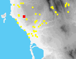 M05
Gargaliani Analipsi
Periods Represented
Late HL, ER, LR, R-Byz, Byz, Byz-Ott, Ott/Ven, EMod, (Mod)
Max Dimension
200 m. (NE-SW) x 200 m. (SE-NW)
Actual Area in Hectares
3
On-site Density (Sherds per Hecatare)
5.98
Ratio of On-site Density to Off-site Density
1261
Collection Strategy
Tract collection only
Location and Description
Ca. 1.5 km. SSW of the center of Gargaliani lies a modern church of Ayios Padteleïmon. For ca. 600 m. N of this church along a steep bedrock scarp there are various rock cut features, including small niches carved into vertical bedrock[099.20], regularly cut chambers[098.32], a church built into a modified cave[099.06], and some sections of quarries similar to those preserved on top of the scarp S of Gargaliani. The site, as defined by distribution of artifacts, extends to the plateau above these various architectural features, and down the slopes, ca. 150 m. below and to the W of the scarp.
Architectural features associated with the site include a church and storage facilities built into the scarp ca. 400 m. N of Ay. Padteleïmon. The single-aisled, vaulted church (interior dims. 13 x 5 m.) employs a naturally formed cave and is completed by walls formed of well cut limestone[099.29]. It is entered through a door on the S wall and a there is a single window on the W side. The S and N sides of the interior are lined with benches cut from the bedrock and the E wall terminates in a wide apse lined with a wall[098.25]. Within the church the northern pier of the templon screen, cut from the bedrock, is preserved. Adjacent to this feature, there is a recessed prothesis table and niche. Cuttings into the surrounding stone suggest the former existence of a moulding that would crown this niche. Traces of plaster (possibly painted) were observed in the SW corner of the nave[098.28] at the point where the vault springs from the S wall. To the S of the church is a small recessed storage area with remains of a tile-lined storage bin. The predominance of Byz and Turk material in the area probably suggests a date for the construction and use of the church.
Several other structures in this area employ natural cavities in the limestone scarp, chiefly to the S of the rock-cut church. These structures incude pens for livestock, some of which are enlarged by the construction of fieldstone walls. One notable feature was a number of small niches cut into the limestone ca. 50 m. N of Ay. Padteleïmon, perhaps comparable to cut niches at other sites used for local shrines[099.20].
A limestone statue base with carved mouldings was observed ca. 150 m. NW of the rock-cut church[099.10] and a HL coin[288.06][288.08] ca. 200 m. SW of it.
Intervisible Sites
-
Artifact Summary
Material from this site was studied in the field; it dates from the Roman through Byzantine periods. Particularly well-represented, however, are sherds from the Byzantine and Turkish periods. These material remains may correspond in date to the main architectural feature of this site, the rock-cut church of St. Panteleimon. Byzantine sherds were found [in I95-166, 169, 170, 173, 174, 177, 199 and in contiguous tracts 68, 79, 80]. Few sherds from the Roman period were observed [in tract M94-80]. Turkish and Early Modern sherds were noted in all tracts. Pottery was fairly well preserved and representative types included table wares, cookpot fragments and storage vessel handles.
References
-
All texts and images made available through The Pylos Regional Archaeological Project: Internet Edition are for personal use only. Reproduction of these materials without prior permission is prohibited.
Questions about the PRAP online database can be addressed to John Wallrodt at john.wallrodt@uc.edu.
 A01
Metamorfosi Ayios Konstadtinos (1)
 A02
Metaxada Kalopsana (1)


