MRAP First Season
Institute of Archaeology
Tirane
Albania
November 10, 1998
[The following is a text delivered by Jack L. Davis at the 50th Anniversary Celebration of the Albanian Institute of Archaeology. Information in the report was provided by members of the project, particularly Muzafer M. Korkuti, Lorenc Bejko, Michael L. Galaty, Skënder Muçaj, Sharon R. Stocker, and Charles Watkinson.]
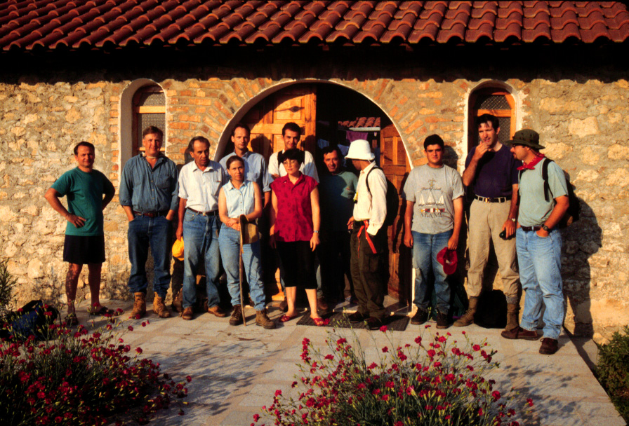
In Cincinnati, Ohio, in 1996, the Director of your Institute, Dr. Muzafer Korkuti, introduced Albananian archaeology and the proud traditions of your Institute to me, my wife, Sharon Stocker, my colleagues and students. Today, only three years later, it is a suprise, a joy, and an honor to be invited to speak to such an august international audience here in Tirane and to share with you, on behalf of colleagues 98.01, Dr. Korkuti, Skënder Muçaj, Lorenc Bejko, Michael Galaty, and Sharon Stocker, the results of the first season of fieldwork of the Mallakastra Regional Archaeological Project 98.02, a program of regional surface archaeological investigations jointly sponsored by your Institute and the University of Cincinnati. Thank you for your patience. I hope that on the next such occasion I will be able to deliver my presentation in the Albanian tongue.
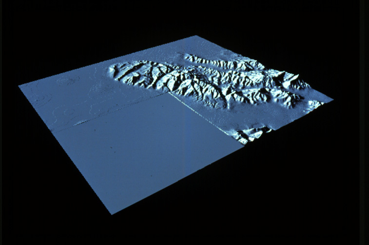
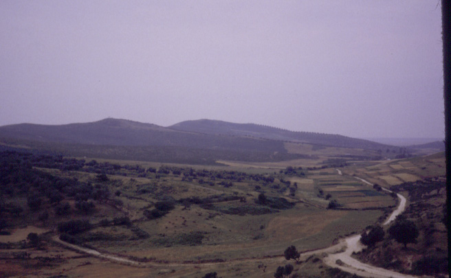
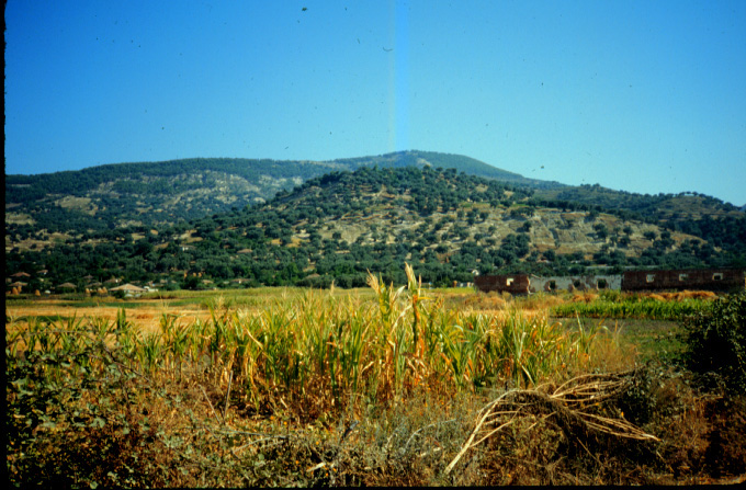
Albania offers great potential for the application of modern techniques of archaeological surface survey, techniques that have been commonly applied in the past two decades in neighboring countries: 98.03 e.g., Turkey, Macedonia, Croatia, Greece, and Italy. Like other Mediterranean countries, the Albanian landscape and natural environment are well suited to this type of investigation, and the Mallakastra district 98.04; 98.05 offers the very real advantage that it has not yet been greatly changed by mechanized agricultural or industrial development, nor has tourism so far had a damaging impact. At the same time, members of your Institute have been active, with scientific excavations at sites of all periods and a record of prompt publication. Such a background provides essential information with regard to cultural sequences and chronologies upon which survey-based research can build.
Surface survey, as we ourselves have practised it, now for nearly twenty-five years, is regional, multi-period, and inter-disciplinary. In most countries, archaeology has had a strong focus on the larger and more prominent sites--whether cities 98.06, towns, hillforts, cemeteries, temples 98.07), or tumuli 98.08--which offer the best opportunities for revealing plans, stratified sequences of material, and rich finds. What survey-based research has amply demonstrated is how much may be learned by situating the results of such excavations within a wider regional framework, one in which sites of all types and sizes are brought into consideration. It is not the richness or suitability for future excavation of such sites that is important (many in fact may be relatively impoverished, or poorly preserved). Rather, these sites, once located and mapped, collectively provide the means to understand past patterns of settlement, ancient systems of economy and exploitation, and the relations between town and country, or between different categories of people. Above all, a regional approach helps us to explain how all of these may have changed in the course of centuries and millennia. Because modern surveys are intensive and systematic, and conducted in an organized manner by small teams of experienced archaeologists 98.09, they often discover many hundreds of new sites, even in areas where much archaeological exploration and excavation has already taken place.
In addition, a survey project has the potential to discover sites of all periods represented in the region under investigation, from the Palaeolithic through the modern era. One of the real benefits, in fact, of a systematic survey is to provide an inventory of the archaeological resources of a region, which can then help guide later decisions about site protection or future programs of excavation. Nonetheless, it is necessary for a survey to address some over-arching scientific and historical problems, which govern where and how research should be conducted. In our case, the main problem (but not the only one) to which we hope to make some contribution concerns the interaction between native Illyrians 98.10 and the Greek colonists living at Apollonia 98.11--a matter of great significance not only specifically for the early history and archaeology of Albania, but more generally for our understanding of the processes and impact of colonialism itself. We want to emphasize, however, that the research goals of our project are multiple, and by no means restricted to historical periods. In fact, as we shall soon see, survey has much to contribute to our understanding of Albania's prehistory.
Another important aspect of our project is the undertaking of various inter-disciplinary scientific studies which serve to enrich our interpretations of the strictly archaeological data. For example, we have initiated technical studies of regional landscape change, designed by geoarchaeologist 98.12 Eberhard Zangger. Next year we may be joined by a palynologist, Sergei Yazvenko, who will work to reconstruct long-term fluctuations in vegetation under the impact of both climate and human activities, and a soil scientist, who will identify and describe regional soil types. This program of scientific investigation can be expected to provide a strong ecological component to reconstructed patterns of past human settlement.
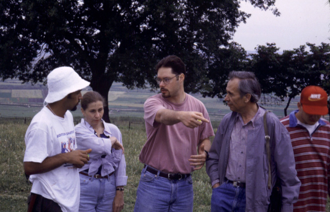
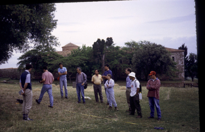
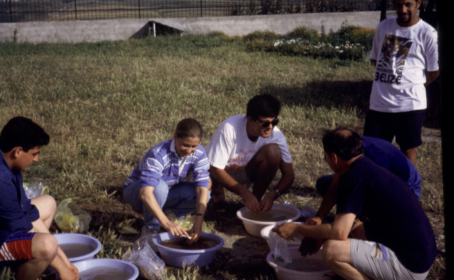
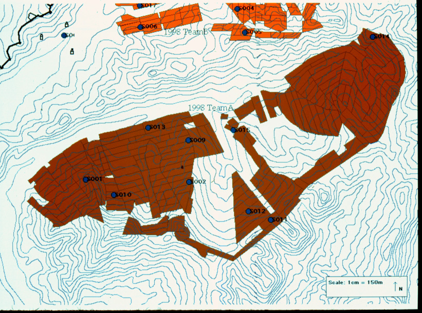
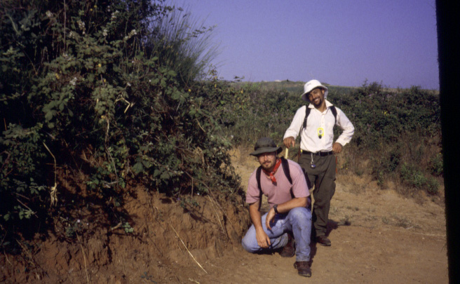
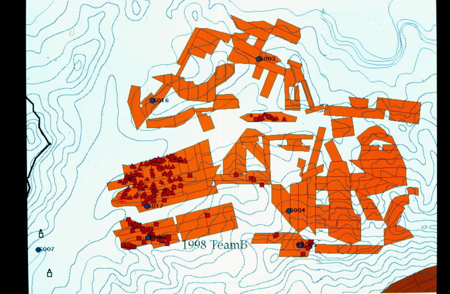
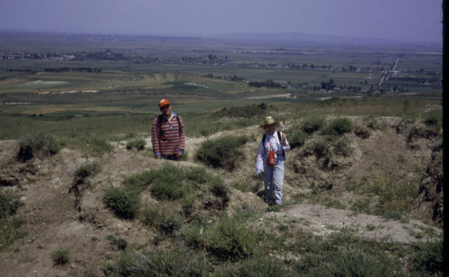
As mentioned above, regional surface survey is a systematic endeavor. A team 98.13 of trained archaeologists walks fields--or tracts, as we call them--spaced at intervals of 15 meters, employing compasses to maintain a predetermined bearing. These tracts may be defined naturally, with reference to geographic boundaries, or arbitrarily, and typically are kept relatively small in areal extent. The goal is complete coverage of a given landscape, although for various reasons this goal is not always obtained. 98.14 Artifacts--most often potsherds and lithics--are counted and are kept if thought to be diagnostic to a particular time period. In this way tract artifact density can be calculated and--following positive identification of collected artifacts by museum personnel--regional fluctuations in land-use and occupation can be traced through time. Thus survey generates spatial as well as temporal information.
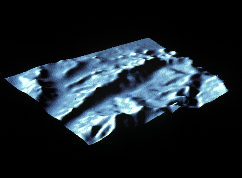
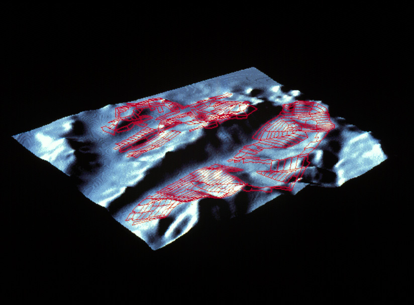
Key to the successful practice of survey is the careful recording of data. As survey progresses, a "team leader" locates and plots all tracts on a computerized topographical map or Geographical Information System. 98.15; 98.16The team leader also records a description of each tract, including vegetation, surface visibility, soil color, and any architectural features. As a result, confounding factors, such as visibility, can then be related to tract artifact density. For example, a portion of land may have produced few artifacts not because it was underutilized in antiquity, but because surveyors had difficulty seeing the ground surface. Our Geographical Information System, thereby allows results to be assessed immediately and project investigative strategies adjusted.
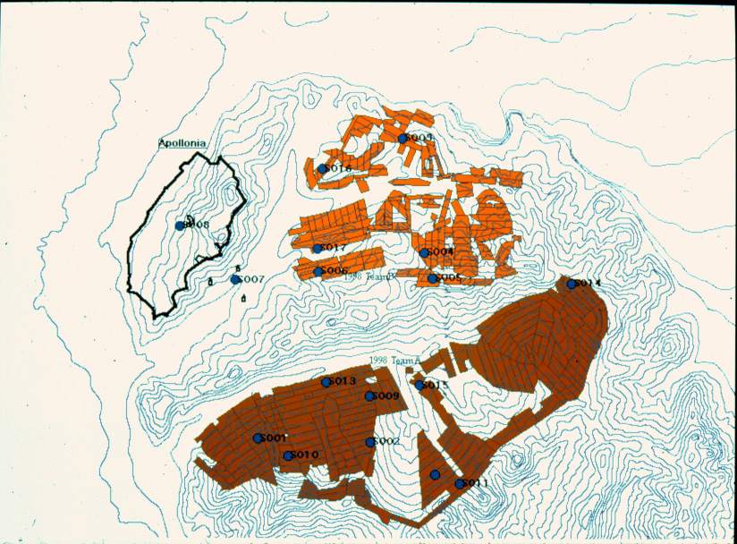
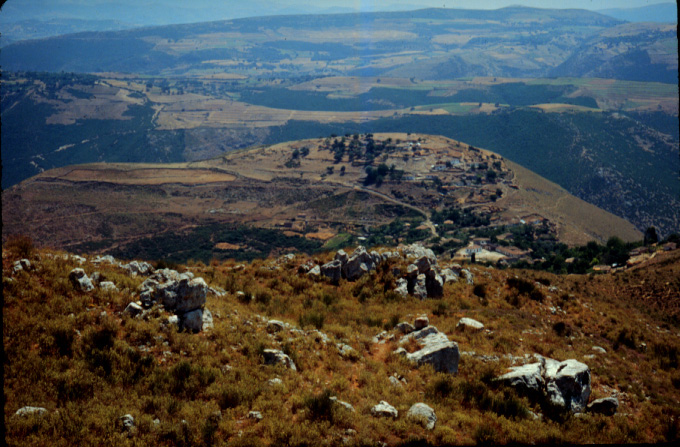
An area of high artifact density--a "hotspot"--may signal the identification of a site, the location of some past human activity. Oftentimes, previously unknown sites are first found in the process of fieldwalking, to be confirmed later through more intensive artifact collection. 98.17 For example, during the summer of 1998, having surveyed 4.5 square kilometers in the course of ca. 12 days, we managed to identify 15 new or previously unreported sites in the vicinity of Apollonia. Of these 15, most were then revisited and more systematically examined; in most cases sites were gridded and "vacuumed," that is, all artifacts on site were collected and dated. In this way, the size of new sites could be established and their temporal components identified.
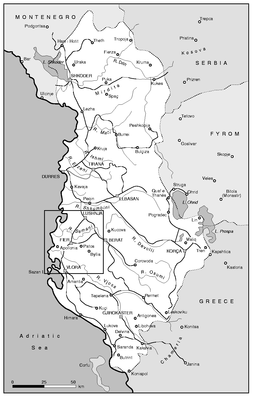
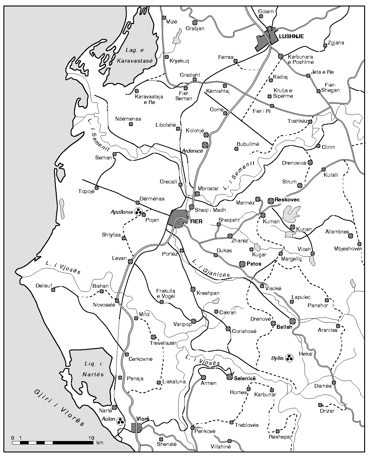
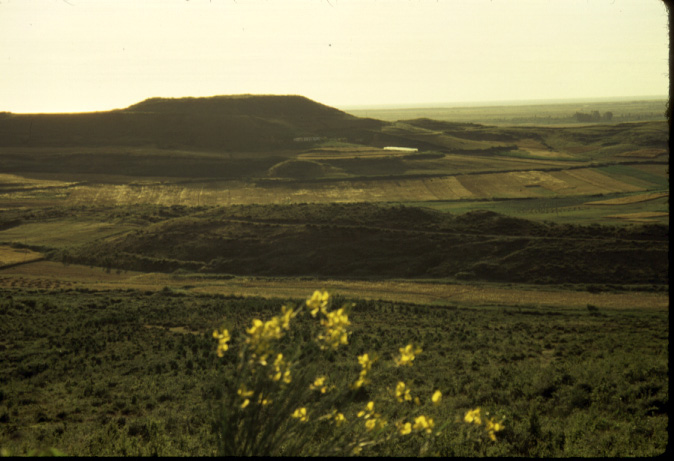
In 1998, two areas in the immediate vicinity of the ancient city of Apollonia were chosen to be targets of intensive surface survey: 98.18 the first, to the east and northeast of the acropolis of the ancient city, between the modern villages of Kryegjata and Havaleas-Radostina, where the principal necropolis of Apollonia is located; the second, in the valley northeast of the modern village of Shtyllas. Although, in the remainder of this paper, we have chosen to concentrate on the description of finds in the Kryegjata area, it is worth mentioning several discoveries in the pë rr. Shtyllasit 98.19.
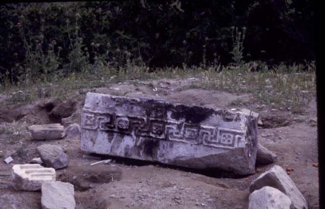
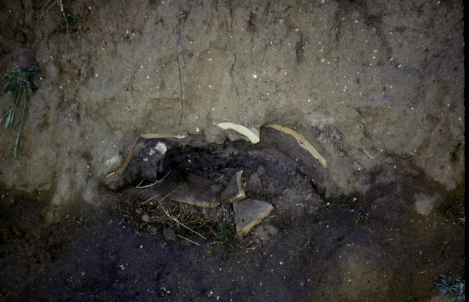
(1) 98.20 Spolia from Apollonia were built into the now destroyed church of Shë ndë lli at our Site 013. An architrave block at present is being used as an altar.
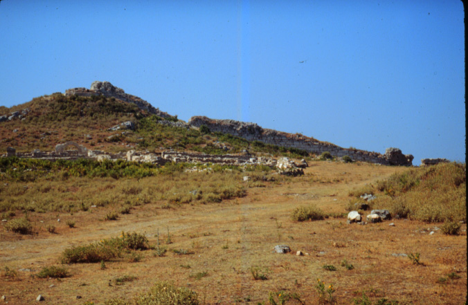
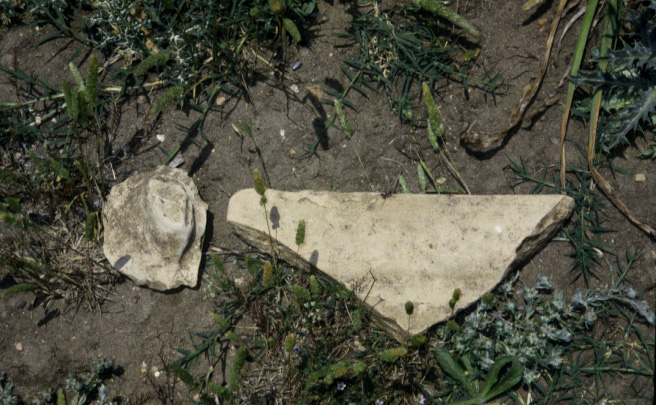
(2) 98.21 Site 014 was the largest Hellenistic site found in the valley. On terraces down the side of the hill we found large quantities of amphorae, cooking wares, lamps, cover and pan tiles. Protruding from a terrace scarp on the lower slope of the hill was a human skull. On the same part of the hill a large fragment of pan tile bore the stamp "IT", also recognised at Apollonia by Alessandra Mano and dated there to the 3rd-2nd Century BC.
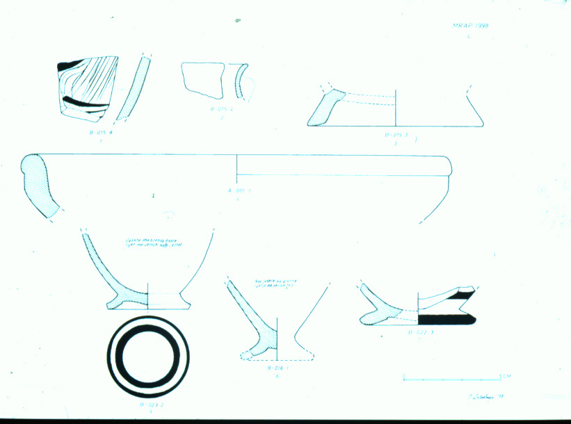
(3) 98.22 Site 015 had a large density of Hellenistic material, but also a strong Roman component. Close to the road and near an abundant water-source now tapped by pumping stations, Site 015 is a very attractively located site. Two small finds of interest were a mill-stone fragment and a bronze coin showing Artemis on the obverse and a spearhead on the reverse with the legend APEIR-WTAN. This was minted by the Koinon of Epirus and can be dated to 234-168 BC.
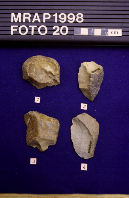
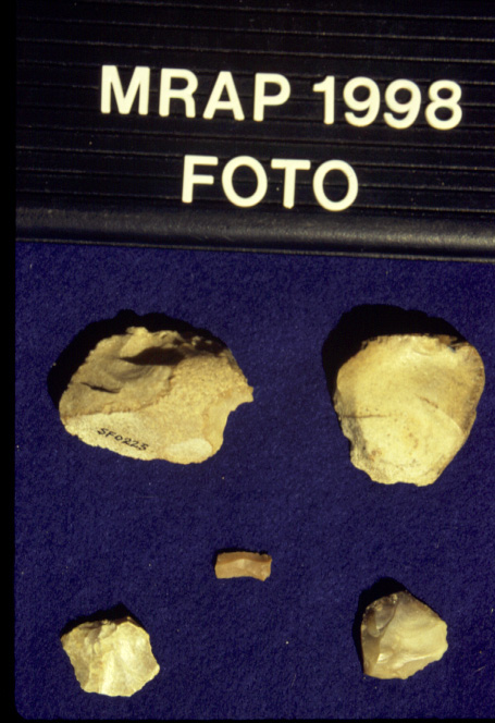
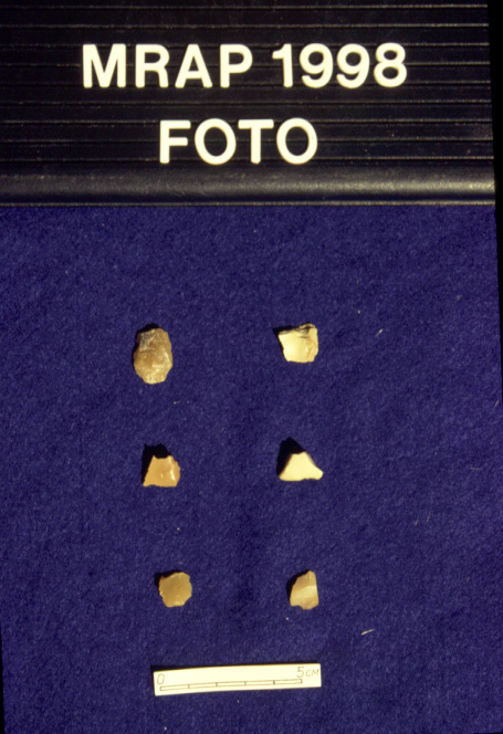
One striking and unexpected result of the 1998 field season was evidence for intensive exploitation of the study region in prehistoric times. Of 409 lithic artifacts 98.23 collected, the majority appear to date to the Middle and Upper Paleolithic periods and to the Mesolithic. In addition, 98.24 a small groundstone axe, typical of the European Neolithic, was recovered in the Shtyllas valley. As of yet we have identified very little evidence, with the exception of a few sherds, for Bronze Age occupation of the region.
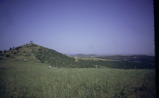
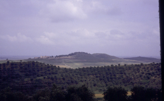
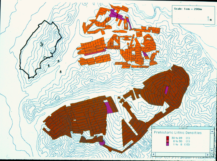
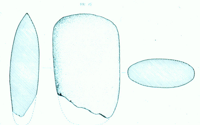
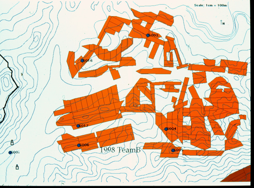
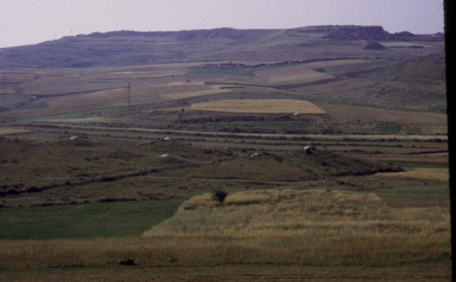
Prior to our work, Stone Age habitation in the Apollonian hinterland had yet to be systematically documented, although Mousterian remains had been reported by Italian archaeologists at Byllis and had been recognized among artifacts recovered from the filling of the mound of the tumulus excavated by Professor Prendi at Vajzë . We identified two certain open-air sites of Stone Age occupation, designated by us as Kryegjata A/Site 17 and B. 98.25 Kryegjata B/Site 3 98.26 is located on a rise with broad views of the valley system linking the modern towns of Kryegjata and Radostina, at distance of several kilometers from the acropolis of Apollonia. Only a very small sample of artifacts have thus far been collected (118 lithics), but it is clear that such finds are distributed over an area of approximately 4 hectares; the site is thus one of the largest of its kind in Albania and is comparable in size to the important Paleolithic station of Kokkinopilos, in Greek Epirus. 98.27; 98.28 Stone-tool types can be attributed to: the Middle Paleolithic--many Mousterian forms, some display use of the Levallois technique; the Upper Paleolithic; and the Mesolithic--several typical microliths, some of them trapezoidal 98.29. Of great significance is the fact that Kryegjata B:
(1) spans the Middle/Upper Paleolithic transition and may provide information as to processes of "acculturation" on the part of late period Neanderthals;
(2) sits on an extremely stable, Pleistocene land surface, and may therefore provide the possibility for attaching radiometric dates to the Middle/Upper Paleolithic transition in Albania;
(3) has produced a complete lithic reduction sequence and thus may represent a very complex and dense site, perhaps a "homebase";
(4) through methods of paleo-environmental reconstruction, such as paleobotany, may allow Paleolithic and Mesolithic site-location strategies to be addressed; and
(5) contains a Mesolithic component, extremely rare in most parts of the Balkans, and thus of great interest.
The outlines of the history of colonial settlement in the Illyrian area are well known, both from the ancient historical sources and from the long-term programs of excavation at the chief coastal sites at Epidamnus-Dyrrachium, Apollonia and Buthrotum, established in the seventh and sixth centuries B.C. Following their intial foundation, these colonies soon began to have an impact on the patterns of settlement and culture of native Illyrians living further inland, and vice versa. Most prominent in the archaeological record is the development, in the Proto-Urban phase, of new types of site--whether true towns, hilltop refuges, or trading centers--in the areas of Illyrian settlement in the interior hinterland (e.g., Gurzezë 98.30, Margelliç 98.31, Byllis 98.32, Klos 98.33). Much excellent work has been conducted at these sites, especially on their systems of fortification and on the changing character of their material culture under Greek influence. However, the processes of their development and their relationships with each other and with the coastal colonies are not yet fully understood. Less well studied are the ways in which land-use and the natural environment in the rural hinterlands of these various central places were affected by the dramatic social, political and economic transformations that occurred in the period between Greek colonization and the Roman annexation of Illyria. This includes the era during which wider networks of political alliance emerged, such as the Koinon of the Bylliones.
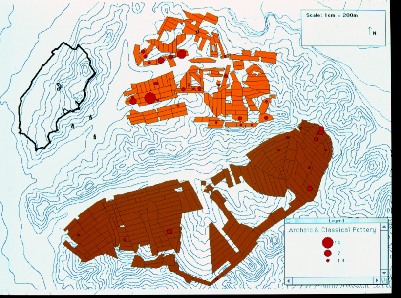
Our preliminary results already suggest that there was first a significant human presence in the immediate vicinity of Apollonia after the establishment of the Greek colony. The largest quantities of Archaic and Classical pottery 98.34; 98.35) we have found are associated with graves in the cemeteries of the Kryegjata valley 98.36; 98.37, although smaller amounts are present in other locations, including the valley of Shtyllas. In the Hellenistic period, finds were still more plentiful: indeed, Hellenistic finds were ten times as common as Classical in the areas we examined. An intensively occupied and cultivated Hellenistic landscape of the sort implied by such a pattern contrasts markedly with the results of virtually every regional study so far conducted in Greece or western Turkey. In those studies it has been found that the Classical period, especially the late Classical period (first three quarters of the fourth century B.C.), was a period of maximum expansion in rural settlement, whereas Hellenistic and early Roman landscapes appear to have been comparatively vacant.
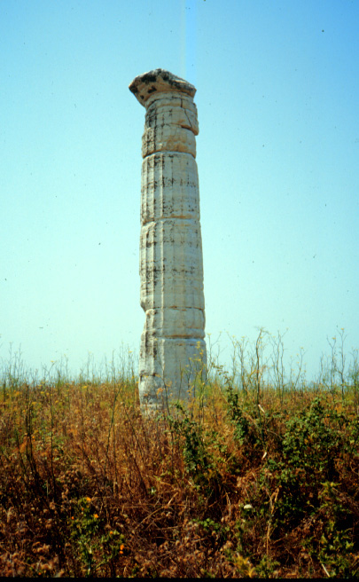
Tumuli 98.38, sarcophagi, and graves 98.39; 98.40, in use during the Archaic, Classical, and Hellenistic periods, were also surveyed and mapped in great numbers in what is traditionally thought to have been the main necropolis serving the city of Apollonia. However, significant numbers of graves and several previously unrecorded tumuli were also located in areas well removed from the main necropolis. As was made clear by various early travellers to Apollonia, and by several Albanian and foreign archaeologists since, burials are to be found throughout most of the valley system east of the city walls of Apollonia 98.41. Intensive survey can help to define more exactly the extent of these features in the general vicinity of the ancient city, particularly those that lie outside the known boundaries of the main necropolis.
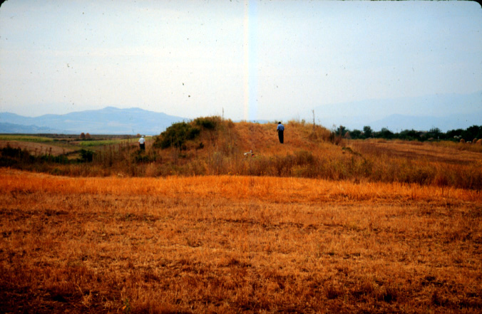
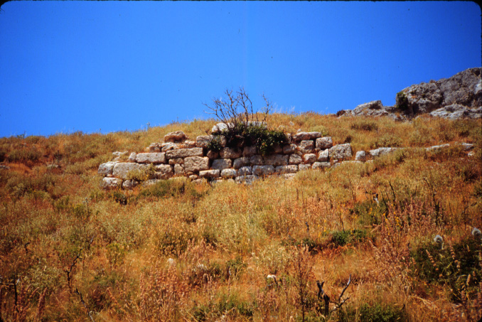
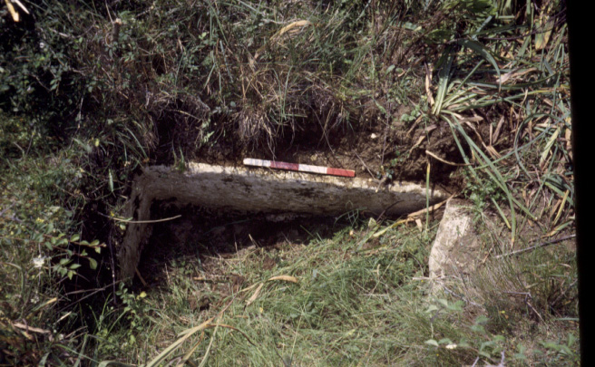
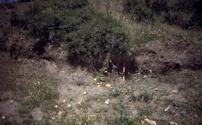
Site collections of two large, previously unrecorded, tumuli further indicate the very complex nature of these burial monuments. 98.42; 98.43; 98.44 Both mounds, like this badly damaged example on k. Kripë s, were measured and divided into quadrants, from each of which were collected a sample of diagnostic ceramics. As expected, Archaic, Classical, and Hellenistic forms were identified, but proto-Urban pottery (tract B-055) and Roman tile were also present. In addition, ceramic types typically not associated with graves--such as cook pots, cover tiles, and Hellenistic bricks--were identified in great numbers at both sites.
There are other interesting contrasts between our results in 1998 and those of other surveys that have been conducted in nearby areas of the eastern Mediterranean. For example:
1) In almost every survey in Greece, sites of Late Antiquity (4th-early 7th centuries A.D.) have been among the most plentiful recorded. Finds of these centuries are thus far completely absent from our collections;
2) Similarly, finds of the Middle Byzantine period (11-13th centuries A.D.) are noticeably missing in the areas we have examined, whereas small sites of this date have been found to be extremely common elsewhere in the southern Balkans.
It is, on the other hand very encouraging that we have been able to identify substantial concentrations of pottery of the Ottoman period at two sites, one near the watershed between Radostina and Kryegjata.
In 1999, we plan to return to Mallakastra to expand the regional coverage of our investigation. Two teams will operate simultaneousl in unexamined areas between Shtyllas and Levan.
A third team will employ a Total Station, an Electronic Distance Measuring machine [EDM], to produce three-dimensional computer plans of Kryegjata B and the Apollonia nekropolis. The Total Station will be used at Kryegjata B:
(1) to map landscape features (such as an associated field road) and surface elevations, including the extent and depth of Pleistocene soil formations;
(2) to generate a surface grid system that will facilitate surface collection of all on-site lithic material;
(3) to map the location of each lithic artifact subsequently collected.
The latter is an exercise rarely employed inthe surface collection of Paleolithic open-air sites, but one that can be expected to yield extremely important spatial, chronological, and perhaps functional information about the site. This information can in the future be used as a guide to excavation, should that be desirable.
Finally, Apollonia's necropolis is suffering from the beginnings of soil erosion and from the attention of looters. A systematic map of the site can aid in the protection and conservation of this fantastic archaeological site. In addition, the examination of mapped tumuli clusters and associated surface artifacts may inform as to changes in burial customs through time and to differences between various Apollonian social groups.