 K03 Valta Kastraki
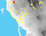
The high ridge of Kastraki is an interfluve at the juncture of two subsidiary streams that combine to form the Lagkouvardos River.[088.25] The ridge consists of two prominent knolls and the saddle between them.[088.26] The location affords spectacular views of the Langouvardos gorge to the west.[088.27] Valta village lies ca. 200 m. in a direct line N of Kastraki, across a deep ravine.
Dense maquis covers the tops of both knolls; the saddle and the southern slopes of the knolls have been terraced and are planted with mature but not particularly old olives. The N side of the NE knoll is uncultivated but terraced.
On the summit of the SW knoll, hidden in dense maquis, are the remains of a wall at least 10 m. in length and 1 m. thick; the wall is preserved to a height of three or four courses (0.5-0.75 m.), and is built of small, roughly worked blocks.[071.33]
A dirt road, cut by a bulldozer, climbs to the saddle, skirting the S side of the eastern knoll. In 1994 two distinct concentrations of painted Mycenaean pottery were eroding from this scarp, ca. 1.2 m. apart, ca. 75 m. from the main asphalt road linking Valta to Gargaliani; human bone was also visible.[071.37] Several stones in the scarp were arranged in a distinctly arch-shaped array ca. 3 m. across.
The pottery and stones seem clearly to be the remains of burials, perhaps of a monumental tomb, cut by the bulldozing of the dirt road. Material associated with the burials is of LH IIIA-B date. In 1995, we observed that additional pottery and bone had eroded from the road scarp.
Elsewhere on the site artifact densities were highest in the saddle and on the slopes to the south of it. Finds from the site, other than those associated with the burials already described, were of MH-LH II date, with the exception of a few modern tiles and sherds.
The site of Kastraki was first investigated by Hope Simpson and McDonald who reported MH and LH III pottery, with a possible MH tumulus on the NE knoll and a possible Mycenaean tholos tomb in the area where we found graves. Indeed, one fragment of a Mycenaean feeding bottle that they report is likely to have belonged to the nearly complete vessel that we recovered. We, on the other hand, found no evidence for an MH tumulus and it seems more likely that the LH III burials had been set into the remains of an earlier MH-LH II settlement.
Pottery collected from this site falls into two distinct groups. Material from the tombs in tract 504 is LH IIIA-B; the rest of the site yielded MH-LH II material exclusively, with the exception of a few modern tiles and sherds.